Area Overview for HR8 2UP
Photos of HR8 2UP
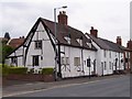


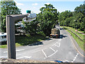
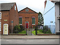
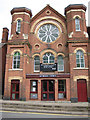
100 photos from this area
Area Information
Key information about the HR8 2UP including its size, population, and administrative classification.
- Area Type
- Postcode
- Area Size
- 5038 m²
- Population
- 1647
- Population Density
- 4056 people/km²
House Prices in HR8 2UP
12
Properties
£155,267
Average Sold Price
£52,000
Lowest Price
£380,000
Highest Price
Showing 12 properties
| Address | Type | Beds | Baths | Last Sale Price | Last Sale Date | |
|---|---|---|---|---|---|---|
| 10 Brooke Road, Ledbury, HR8 2UP | house | - | - | £318,500 | Aug 2025 | |
| 1 Brooke Road, Ledbury, HR8 2UP | house | - | - | £215,000 | Mar 2021 | |
| 2 Brooke Road, Ledbury, HR8 2UP | house | - | - | £205,000 | May 2017 | |
| 15 Brooke Road, Ledbury, HR8 2UP | Detached | 4 | 1 | £380,000 | Dec 2015 | |
| 5 Brooke Road, Ledbury, HR8 2UP | Terraced | 4 | 2 | £219,250 | Dec 2013 | |
| 3 Brooke Road, Ledbury, HR8 2UP | Terraced | 2 | 2 | £82,500 | May 2008 | |
| 11 Brooke Road, Ledbury, HR8 2UP | Terraced | - | - | £147,000 | Nov 2003 | |
| 8 Brooke Road, Ledbury, HR8 2UP | Terraced | 2 | - | £59,950 | Feb 2001 | |
| 4 Brooke Road, Ledbury, HR8 2UP | Terraced | - | - | £67,500 | Jan 2001 | |
| 9 Brooke Road, Ledbury, HR8 2UP | Terraced | 2 | - | £57,500 | Nov 1998 |
Page 1 of 2
Energy Efficiency in HR8 2UP
Amenities
Schools
| Rank | School | Type | Entry gender | Ages |
|---|
Explore more schools in this area
Go to Schools tabDemographics
Household Size
Two person
most common
Accommodation Type
Houses
most common
Tenure
73
majority
Ethnic Group
White
most common
Religion
N/A
most common
Household Composition
N/A
most common
Age
47
median
Adults (30-64 years)
most common
Household Deprivation
N/A
with no deprivation
NS-SEC
39
in Lower managerial occupations
Explore more demographic insights in this area
Go to Demographics tabPlanning
Planning Constraints
- Flood RiskPremium
- Ramsar Wetland SitesPremium
- Area of Outstanding Natural BeautyPremium
- Protected Nature ReservePremium
- Protected WoodlandPremium