Area Overview for HR8 2PN
Photos of HR8 2PN
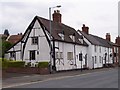
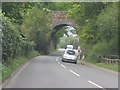
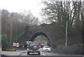
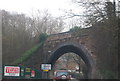
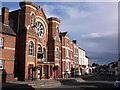
100 photos from this area
Area Information
Key information about the HR8 2PN including its size, population, and administrative classification.
- Area Type
- Postcode
- Area Size
- 1.4 hectares
- Population
- 1647
- Population Density
- 4056 people/km²
House Prices in HR8 2PN
35
Properties
£174,815
Average Sold Price
£41,000
Lowest Price
£395,000
Highest Price
Showing 35 properties
| Address | Type | Beds | Baths | Last Sale Price | Last Sale Date | |
|---|---|---|---|---|---|---|
| 7 Golding Way, Ledbury, HR8 2PN | house | 3 | 1 | £275,000 | May 2024 | |
| Fuggles, 25 Golding Way, Ledbury, HR8 2PN | Semi-detached | 2 | 1 | £232,000 | May 2024 | |
| 33 Golding Way, Ledbury, HR8 2PN | Detached | 4 | - | £392,500 | Jan 2020 | |
| 36 Golding Way, Ledbury, HR8 2PN | Detached | 4 | - | £375,000 | Jun 2019 | |
| 1 Golding Way, Ledbury, HR8 2PN | Detached | 4 | 2 | £395,000 | Nov 2018 | |
| 21 Golding Way, Ledbury, HR8 2PN | house | - | - | £210,000 | Nov 2017 | |
| 28 Golding Way, Ledbury, HR8 2PN | house | - | - | £146,500 | Jul 2017 | |
| 3 Golding Way, Ledbury, HR8 2PN | Semi-detached | 2 | 1 | £167,000 | May 2017 | |
| 23 Golding Way, Ledbury, HR8 2PN | Semi-detached | 2 | - | £161,500 | Apr 2015 | |
| 19 Golding Way, Ledbury, HR8 2PN | house | 3 | - | £186,000 | Mar 2015 |
Page 1 of 4
Energy Efficiency in HR8 2PN
Amenities
Schools
| Rank | School | Type | Entry gender | Ages |
|---|
Explore more schools in this area
Go to Schools tabDemographics
Household Size
Two person
most common
Accommodation Type
Houses
most common
Tenure
73
majority
Ethnic Group
White
most common
Religion
N/A
most common
Household Composition
N/A
most common
Age
47
median
Adults (30-64 years)
most common
Household Deprivation
N/A
with no deprivation
NS-SEC
39
in Lower managerial occupations
Explore more demographic insights in this area
Go to Demographics tabPlanning
Planning Constraints
- Flood RiskPremium
- Ramsar Wetland SitesPremium
- Area of Outstanding Natural BeautyPremium
- Protected Nature ReservePremium
- Protected WoodlandPremium