Area Overview for HR8 2NQ
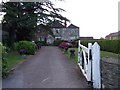
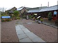
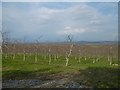
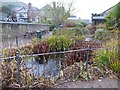
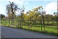
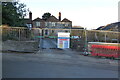
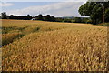
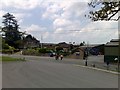
Photos of HR8 2NQ
Area Information
HR8 2NQ is a small, low-density residential cluster in England, covering 7.5 hectares and home to 1323 residents. With a population density of 29 people per square kilometre, the area offers a quiet, spacious living environment. The postcode is nestled in a setting where natural spaces and local amenities coexist. Residents benefit from proximity to Ledbury Railway Station, which connects to broader networks, and nearby retail options such as Aldi, Spar, and Co-op in Ledbury. The area’s safety is notable, with a crime risk score of 86/100, reflecting below-average crime rates. While the community is small, it is served by essential services and has a distinct character shaped by its rural context. Living here means enjoying a balance of seclusion and accessibility, with the area’s compact size making it easy to navigate. For those seeking a peaceful, low-traffic neighbourhood with practical connectivity, HR8 2NQ provides a straightforward alternative to denser urban environments.
- Area Type
- Postcode
- Area Size
- 7.5 hectares
- Population
- 1323
- Population Density
- 29 people/km²
The property market in HR8 2NQ is likely characterised by a mix of owner-occupied homes, given the area’s low population density and the presence of a single primary school. The small size of the postcode suggests a limited number of properties, possibly concentrated in single-family homes or small terraces. With no specific data on rental rates or home ownership percentages, it is reasonable to assume that the market is not dominated by high-rise or commercial developments. The area’s proximity to Ledbury Railway Station and retail amenities may make it attractive to buyers seeking a balance of rural tranquillity and practical connectivity. However, the limited size of the postcode means the housing stock is unlikely to be extensive, and buyers should consider the immediate surrounding areas for more options. The lack of large-scale planning constraints, such as AONB or protected woodland, may also make it easier to acquire property without restrictive conditions.
House Prices in HR8 2NQ
Showing 1 properties
| Address | Type | Beds | Baths | Last Sale Price | Last Sale Date | |
|---|---|---|---|---|---|---|
| The Bounds, C 1262 From C 1294 To Cherry Orchard Lane, Much Marcle, HR8 2NQ | Detached | - | - | - | - |
Energy Efficiency in HR8 2NQ
Residents of HR8 2NQ have access to nearby retail amenities, including Aldi, Spar, and Co-op in Ledbury, providing essential shopping options within practical reach. The area’s small size means daily life is centred around these local venues, which cater to household needs. While the data does not mention parks or leisure facilities, the absence of planning constraints such as AONB or protected woodlands suggests space for informal outdoor activities. The presence of a railway station and nearby shops contributes to a self-contained lifestyle, though residents may need to travel further for specialist services. The area’s character is defined by its compactness and the convenience of nearby amenities, making it suitable for those prioritising accessibility over extensive leisure options.
Amenities
Schools
The primary school closest to HR8 2NQ is Much Marcle CofE Primary School, which holds an Ofsted rating of outstanding. This school serves the local community and is likely the main educational option for children in the area. With no secondary schools listed in the data, families may need to look beyond HR8 2NQ for secondary education. The presence of a high-rated primary school suggests that the area is appealing to families prioritising early education quality. However, the absence of other school types, such as secondary or specialist institutions, means parents should consider commuting for older children. The school’s outstanding rating indicates a strong local education foundation, which could be a key factor for prospective buyers.
| Rank | School | Type | Entry gender | Ages |
|---|
Explore more schools in this area
Go to Schools tabDemographics
The population of HR8 2NQ is 1323, spread across 7.5 hectares, resulting in a low density of 29 people per square kilometre. This suggests a mix of single-family homes and possibly some larger properties, though specific household composition data is not available. The area’s small size and low density imply a community likely characterised by fewer high-density housing types. Without detailed age or diversity statistics, it is challenging to describe the demographic profile fully. However, the low population density and the presence of a single primary school suggest a mix of family and possibly older residents. The area’s safety score of 86/100 indicates a relatively secure environment, which may appeal to a range of demographics seeking stability. The absence of specific data on home ownership or household types means this section focuses on what is explicitly provided: a compact, low-density community with limited public data on its broader social makeup.
Household Size
Accommodation Type
Tenure
Ethnic Group
Religion
Household Composition
Age
Household Deprivation
NS-SEC
Explore more demographic insights in this area
Go to Demographics tabPlanning
Planning Constraints
- Flood RiskPremium
- Ramsar Wetland SitesPremium
- Area of Outstanding Natural BeautyPremium
- Protected Nature ReservePremium
- Protected WoodlandPremium