Area Overview for HR8 2JN
Photos of HR8 2JN
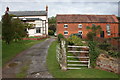
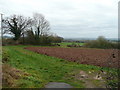
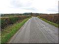
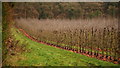
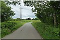
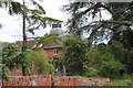
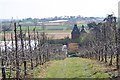
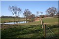
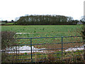
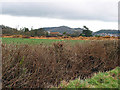
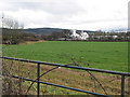
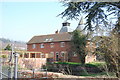
22 photos from this area
Area Information
Key information about the HR8 2JN including its size, population, and administrative classification.
- Area Type
- Postcode
- Area Size
- 85.2 hectares
- Population
- 1681
- Population Density
- 45 people/km²
House Prices in HR8 2JN
19
Properties
£385,000
Average Sold Price
£385,000
Lowest Price
£385,000
Highest Price
Showing 19 properties
| Address | Type | Beds | Baths | Last Sale Price | Last Sale Date | |
|---|---|---|---|---|---|---|
| Golden Grove, Falcon Lane, Ledbury, HR8 2JN | Bungalow | 4 | 1 | £385,000 | Jun 2013 | |
| 2, Kimberrows, Falcon Lane, Ledbury, HR8 2JN | Semi-detached | 2 | 2 | - | - | |
| Flights Farm, C 1308 Little Marcle Road, Ledbury, HR8 2JN | Detached | 6 | 4 | - | - | |
| Plot 1 Log Cabin At Woodside Lodges, Falcon Lane, Ledbury, HR8 2JN | Land | - | - | - | - | |
| Visitors Centre, Tyrels Fruit Farm, Falcon Lane, Ledbury, HR8 2JN | Office | - | - | - | - | |
| Walsingham Support, Office, Keepers Cottage Care Home, Falcon Lane, Ledbury, HR8 2JN | Office | - | - | - | - | |
| The Annexe, Tyrels Frith Farm, Falcon Lane, Ledbury, HR8 2JN | Detached | - | - | - | - | |
| Log Cabin 2, Spring Pool Lodges Tyrels Frith Farm, Falcon Lane, Ledbury, HR8 2JN | hotel | - | - | - | - | |
| Log Cabin 3, Spring Pool Lodges Tyrels Frith Farm, Falcon Lane, Ledbury, HR8 2JN | hotel | - | - | - | - | |
| Log Cabin 1, Spring Pool Lodges Tyrels Frith Farm, Falcon Lane, Ledbury, HR8 2JN | hotel | - | - | - | - |
Page 1 of 2
Energy Efficiency in HR8 2JN
Amenities
Schools
| Rank | School | Type | Entry gender | Ages |
|---|
Explore more schools in this area
Go to Schools tabDemographics
Household Size
Two person
most common
Accommodation Type
Houses
most common
Tenure
73
majority
Ethnic Group
White
most common
Religion
N/A
most common
Household Composition
N/A
most common
Age
47
median
Adults (30-64 years)
most common
Household Deprivation
N/A
with no deprivation
NS-SEC
40
in Lower managerial occupations
Explore more demographic insights in this area
Go to Demographics tabPlanning
Planning Constraints
- Flood RiskPremium
- Ramsar Wetland SitesPremium
- Area of Outstanding Natural BeautyPremium
- Protected Nature ReservePremium
- Protected WoodlandPremium