Area Overview for HR8 1EA
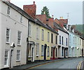
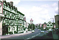
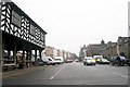
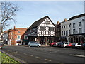
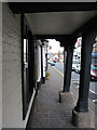
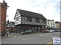
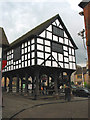
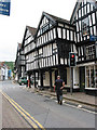
Photos of HR8 1EA


Area Information
Living in HR8 1EA offers a compact, densely populated residential experience within a small cluster of homes. The area covers 3,084 square metres and is home to 1,714 residents, translating to a population density of over 555,000 people per square kilometre. This suggests a tightly knit community, where proximity to neighbours is inevitable. The area’s character is shaped by its modest scale — it is not a sprawling suburb but a focused cluster of properties, likely centred around local amenities. Daily life here is influenced by its proximity to retail and transport hubs, with nearby shops and railway stations within practical reach. The demographic profile, dominated by adults aged 30–64, indicates a mature population, which may contribute to a stable, established community feel. While the area lacks natural or protected landscapes, its accessibility to essential services and infrastructure makes it a pragmatic choice for those prioritising convenience over expansive surroundings.
- Area Type
- Postcode
- Area Size
- 3084 m²
- Population
- 1714
- Population Density
- 3500 people/km²
The property market in HR8 1EA is characterised by a 43% home ownership rate, with houses being the predominant accommodation type. This suggests a mix of owner-occupied homes and rental properties, though the exact balance between the two is not specified. Given the area’s small size and high population density, the housing stock is likely limited to a small number of properties, which could mean competition for available homes. The presence of houses rather than flats or apartments indicates a focus on family-friendly or larger living spaces, which may appeal to specific buyer demographics. For those considering the area, the compact nature of HR8 1EA means that proximity to amenities and transport is a key factor — buyers should evaluate whether the immediate surroundings offer sufficient access to services and connectivity to meet their needs.
House Prices in HR8 1EA
No properties found in this postcode.
Energy Efficiency in HR8 1EA
Residents of HR8 1EA have access to a range of local amenities within practical reach. The retail sector includes five shops, with notable names such as Spar, Co-op Ledbury, and Tesco Ledbury, providing everyday essentials and groceries. These stores suggest a basic level of convenience for daily shopping needs. The area is also served by two railway stations — Ledbury and Colwall — which offer connections to broader transport networks, facilitating travel to nearby towns and cities. While the data does not mention parks or leisure facilities, the proximity to retail and transport hubs implies a functional lifestyle focused on accessibility. The presence of multiple shops and rail links contributes to a practical, community-oriented environment, though residents may need to travel further for more specialised services or recreational spaces.
Amenities
Schools
| Rank | School | Type | Entry gender | Ages |
|---|
Explore more schools in this area
Go to Schools tabDemographics
The population of HR8 1EA is predominantly adults aged 30–64, with a median age of 47. This suggests a community of middle-aged residents, many of whom may be settled in long-term housing. Home ownership rates stand at 43%, indicating that nearly half of properties are owner-occupied, while the remaining 57% are likely rented. The accommodation type is primarily houses, which is notable given the area’s small size — this implies a mix of family homes and possibly larger dwellings. The predominant ethnic group is White, reflecting a homogenous demographic profile. While no specific data on deprivation or diversity is provided, the absence of significant ethnic or age diversity may influence the social dynamics of the area. The high proportion of adults suggests a community with established careers and family structures, which could impact local services and amenities.
Household Size
Accommodation Type
Tenure
Ethnic Group
Religion
Household Composition
Age
Household Deprivation
NS-SEC
Explore more demographic insights in this area
Go to Demographics tabPlanning
Planning Constraints
- Flood RiskPremium
- Ramsar Wetland SitesPremium
- Area of Outstanding Natural BeautyPremium
- Protected Nature ReservePremium
- Protected WoodlandPremium
- Crime RiskPremium