Area Overview for HR8 1BS
Photos of HR8 1BS
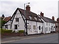
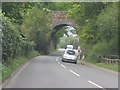
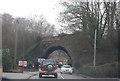
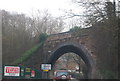
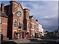
100 photos from this area
Area Information
Key information about the HR8 1BS including its size, population, and administrative classification.
- Area Type
- Postcode
- Area Size
- 9008 m²
- Population
- 1553
- Population Density
- 233 people/km²
House Prices in HR8 1BS
52
Properties
£136,545
Average Sold Price
£25,500
Lowest Price
£270,000
Highest Price
Showing 52 properties
| Address | Type | Beds | Baths | Last Sale Price | Last Sale Date | |
|---|---|---|---|---|---|---|
| Lamorna, The Homend, Ledbury, HR8 1BS | Detached | 3 | 1 | £270,000 | Feb 2025 | |
| 233 The Homend, Ledbury, HR8 1BS | Terraced | - | - | £82,000 | Feb 2025 | |
| 229 The Homend, Ledbury, HR8 1BS | Cottage | 2 | 1 | £171,000 | Oct 2020 | |
| 157 The Homend, Ledbury, HR8 1BS | Terraced | 3 | 1 | £153,000 | May 2018 | |
| 235 The Homend, Ledbury, HR8 1BS | Cottage | 2 | - | £85,000 | Mar 2014 | |
| 183 The Homend, Ledbury, HR8 1BS | Detached | - | - | £240,000 | Apr 2005 | |
| 185 The Homend, Ledbury, HR8 1BS | Detached | - | - | £168,000 | Nov 2003 | |
| 227 The Homend, Ledbury, HR8 1BS | Terraced | - | - | £113,500 | Oct 2002 | |
| 201 The Homend, Ledbury, HR8 1BS | Terraced | - | - | £84,000 | May 2002 | |
| The Old Pottery, 205 The Homend, Ledbury, HR8 1BS | Terraced | 3 | 1 | £110,000 | Jun 2001 |
Page 1 of 6
Energy Efficiency in HR8 1BS
Amenities
Schools
| Rank | School | Type | Entry gender | Ages |
|---|
Explore more schools in this area
Go to Schools tabDemographics
Household Size
Two person
most common
Accommodation Type
Houses
most common
Tenure
71
majority
Ethnic Group
White
most common
Religion
N/A
most common
Household Composition
N/A
most common
Age
47
median
Adults (30-64 years)
most common
Household Deprivation
N/A
with no deprivation
NS-SEC
35
in Lower managerial occupations
Explore more demographic insights in this area
Go to Demographics tabPlanning
Planning Constraints
- Flood RiskPremium
- Ramsar Wetland SitesPremium
- Area of Outstanding Natural BeautyPremium
- Protected Nature ReservePremium
- Protected WoodlandPremium