Area Overview for HR7 4QS
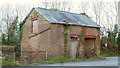
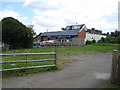
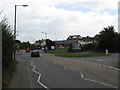
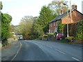
Photos of HR7 4QS
Area Information
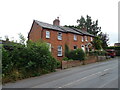
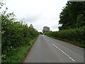
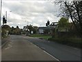
Living in HR7 4QS offers a quiet, compact residential experience in a small cluster of homes. The area spans just 2.1 hectares, housing 1,405 residents at a density of 117 people per square kilometre. This makes it a low-density, community-focused space where daily life is likely shaped by local routines and familiar faces. The area’s character is defined by its predominantly elderly population, with 65+ year olds making up the most common age group. While the median age is 47, this suggests a mix of long-term residents and families. The low crime risk score of 88/100 indicates a safe environment, and the absence of environmental constraints like protected woodlands or wetlands means development is unlikely to be restricted. For those seeking a peaceful, low-maintenance lifestyle with access to basic amenities, HR7 4QS provides a straightforward option. Its proximity to schools, modest retail options, and reliable broadband connectivity makes it suitable for retirees or those prioritising convenience over urban vibrancy.
- Area Type
- Postcode
- Area Size
- 2.1 hectares
- Population
- 1405
- Population Density
- 117 people/km²
The property market in HR7 4QS is dominated by owner-occupied homes, with 85% of properties owned by residents rather than rented. This suggests a stable market with limited turnover, as few properties are available for sale or rent. The accommodation type is primarily houses, which is unusual for a small postcode area but may reflect the land’s suitability for larger dwellings. The low population density and compact size of the area mean there are few properties available, making it a niche market for buyers seeking a specific type of home. For investors, the high home ownership rate and lack of rental properties indicate limited potential for rental income. Buyers should consider that the area’s small size may restrict options for those seeking larger or more varied housing stock. The focus on owner-occupation also suggests a community where properties are likely to be well-maintained and held long-term.
House Prices in HR7 4QS
No properties found in this postcode.
Energy Efficiency in HR7 4QS
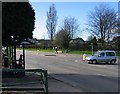
The lifestyle in HR7 4QS is shaped by its proximity to modest retail amenities. Within practical reach, residents can access four retail venues, including Morrisons Daily Bromyard and two Co-op stores in Bromyard. These shops provide essential services like grocery shopping, making daily errands convenient. While the area lacks larger supermarkets or specialised stores, the presence of multiple retail options suggests a basic level of convenience for local needs. The absence of data on dining, parks, or leisure facilities means the area’s recreational offerings are unclear. However, the small size of HR7 4QS implies that residents may rely on nearby towns for more extensive amenities. The retail landscape is practical but limited, catering to everyday needs without the vibrancy of a larger town centre. For those prioritising ease of access to shops and services, this aspect of the area is a straightforward advantage.
Amenities
Schools
Residents of HR7 4QS have access to two named schools within practical reach. Queen Elizabeth Humanities College is a primary school, providing education for younger children, while Queen Elizabeth High School is an academy with an Ofsted rating of ‘good’. This combination of primary and secondary education options offers families a straightforward pathway for schooling, reducing the need to travel long distances. The presence of a high school with a ‘good’ rating is a positive indicator for parents prioritising academic quality. However, the absence of other schools or nurseries means families may need to rely on these two institutions for all stages of education. The proximity of both schools to the area suggests they are well-integrated into the local community, potentially offering extracurricular activities or community events. For those considering HR7 4QS, the school options are a key factor in assessing the area’s suitability for families.
| Rank | School | Type | Entry gender | Ages |
|---|---|---|---|---|
| 1 | Queen Elizabeth Humanities College | primary | N/A | N/A |
| 2 | Queen Elizabeth High School | academy | N/A | N/A |
Explore more schools in this area
Go to Schools tabDemographics
The community in HR7 4QS is predominantly elderly, with 65+ year olds forming the largest age group. The median age of 47 reflects a population skewed towards older adults, though not exclusively so. Home ownership is high at 85%, indicating a stable, long-term resident base rather than a transient rental market. The accommodation type is primarily houses, which aligns with the area’s low density and small size. The predominant ethnic group is White, though no specific diversity statistics are provided. This demographic profile suggests a community with established roots, where families may have lived for generations. The low population density and high home ownership rate imply a quieter, less crowded environment, which could appeal to those seeking privacy or a slower pace of life. However, the absence of data on deprivation or income levels means the area’s economic profile remains unclear.
Household Size
Accommodation Type
Tenure
Ethnic Group
Religion
Household Composition
Age
Household Deprivation
NS-SEC
Explore more demographic insights in this area
Go to Demographics tabPlanning
Planning Constraints
- Flood RiskPremium
- Ramsar Wetland SitesPremium
- Area of Outstanding Natural BeautyPremium
- Protected Nature ReservePremium
- Protected WoodlandPremium
- Crime RiskPremium