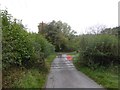
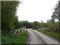
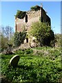
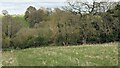
Area Overview for HR7 4LD
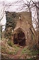
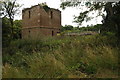
Photos of HR7 4LD

Area Information
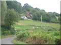
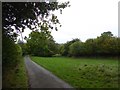
Living in HR7 4LD means being part of a small, tightly knit residential cluster in England, where 1,405 people reside across 9.3 hectares. The area’s compact size fosters a close-knit community, with a population density of 117 people per square kilometre. This postcode is characterised by a predominantly elderly population, with a median age of 47 and 65+ year-olds forming the largest age group. The housing stock here is largely owner-occupied, with 85% of homes being privately owned, and the accommodation is almost exclusively houses rather than flats. Daily life in HR7 4LD is shaped by its small-scale nature, where local amenities and schools are within practical reach. The area’s low population density and lack of significant planning constraints, such as protected woodlands or AONBs, suggest a quiet, unobtrusive living environment. For those seeking a peaceful, mature community with minimal environmental restrictions, HR7 4LD offers a straightforward, low-maintenance lifestyle.
- Area Type
- Postcode
- Area Size
- 9.3 hectares
- Population
- 1405
- Population Density
- 117 people/km²
The property market in HR7 4LD is dominated by owner-occupied homes, with 85% of properties being privately owned. This high level of home ownership points to a community of long-term residents rather than a transient rental market. The accommodation type is exclusively houses, which is uncommon in areas with higher population densities. This suggests a focus on family-friendly, single-family homes, though the small area size of 9.3 hectares limits the availability of new builds or alternative housing types. For buyers, this means a limited pool of properties, all of which are likely to be larger and more traditional in style. The absence of flats or apartments may appeal to those prioritising space and privacy but could make the market less accessible to younger buyers or those seeking investment opportunities. The small area also means that property values may be influenced by proximity to local amenities, such as schools and retail outlets, which are all within a short distance.
House Prices in HR7 4LD
Showing 2 properties
| Address | Type | Beds | Baths | Last Sale Price | Last Sale Date | |
|---|---|---|---|---|---|---|
| The Kilns, C 1135 From River Frome To C 1136, Avenbury, HR7 4LD | Detached | 6 | 2 | - | - | |
| The Kilns Bungalow, C 1135 From River Frome To C 1136, Avenbury, HR7 4LD | Detached | - | - | - | - |
Energy Efficiency in HR7 4LD
The lifestyle in HR7 4LD is shaped by its proximity to retail amenities, including Co-op Bromyard and Morrisons Daily Bromyard, which provide essential shopping and grocery services. These four retail outlets within practical reach ensure that daily needs can be met locally, reducing the need for long commutes. While the data does not mention parks, leisure facilities, or dining options, the presence of these shops suggests a functional, community-focused environment. The area’s small size means that amenities are concentrated, which can enhance convenience for residents. The lack of detailed information on leisure or recreational facilities implies that outdoor activities may require travel to nearby towns. However, the availability of basic retail services supports a self-sufficient lifestyle, particularly for those who prefer minimal travel for routine errands. The character of the area is defined by its practicality and accessibility to essential services.
Amenities
Schools
Residents of HR7 4LD have access to two key educational institutions: Queen Elizabeth Humanities College, a primary school, and Queen Elizabeth High School, an academy with a ‘good’ Ofsted rating. The presence of both a primary and secondary school within the area provides families with a seamless educational pathway for their children. The high school’s ‘good’ rating indicates a satisfactory standard of teaching and facilities, though it does not meet the highest benchmarks. The mix of school types ensures that families can plan for their children’s education without needing to commute far. For those prioritising school quality, the proximity of these institutions is a significant advantage. However, the lack of additional schools or specialist provisions means that parents may need to consider broader options for higher education or extracurricular activities. The schools’ performance reflects the area’s focus on providing accessible, locally based education.
| Rank | School | Type | Entry gender | Ages |
|---|
Explore more schools in this area
Go to Schools tabDemographics
The community in HR7 4LD is defined by its age profile, with a median age of 47 and 65+ year-olds making up the most common age group. This suggests a population skewed towards retirees and older adults, which influences the area’s social dynamics and local services. Home ownership is high, at 85%, indicating a stable, long-term resident base. The accommodation is almost entirely houses, reflecting a preference for single-family homes over flats or apartments. The predominant ethnic group is White, which aligns with broader demographic trends in rural and semi-rural areas. The population density of 117 people per square kilometre is low, contributing to a less crowded, more spacious living environment. While no specific deprivation data is provided, the high home ownership rate and absence of planning constraints suggest a community with relatively stable economic conditions and access to essential services.
Household Size
Accommodation Type
Tenure
Ethnic Group
Religion
Household Composition
Age
Household Deprivation
NS-SEC
Explore more demographic insights in this area
Go to Demographics tabPlanning
Planning Constraints
- Flood RiskPremium
- Ramsar Wetland SitesPremium
- Area of Outstanding Natural BeautyPremium
- Protected Nature ReservePremium
- Protected WoodlandPremium