Area Overview for HR7 4JE
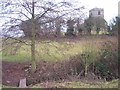
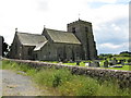
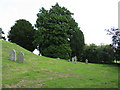
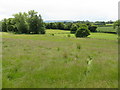
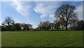
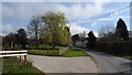
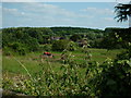
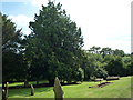
Photos of HR7 4JE

Area Information
HR7 4JE is a small, residential postcode area in England, covering 31.1 hectares with a population of 1626. Its low population density of 33 people per square kilometre suggests a quiet, spacious living environment. The area is characterised by a mature community, with a median age of 47 and the majority of residents falling within the 30-64 age range. This demographic profile indicates a stable, family-oriented neighbourhood where homeownership is prevalent — 78% of homes are owner-occupied. The area’s compact size means it is likely to be a close-knit community, with residents living in houses rather than flats. While the data does not specify the presence of local landmarks or historical sites, the absence of environmental constraints such as protected woodlands or Areas of Outstanding Natural Beauty implies a practical, low-maintenance setting. For those seeking a peaceful, low-density environment with a focus on home ownership, HR7 4JE offers a straightforward, uncluttered lifestyle. Its proximity to essential amenities, including retail outlets and a special school, suggests it is well-served for daily needs, though the small size means it is unlikely to have extensive leisure or cultural offerings.
- Area Type
- Postcode
- Area Size
- 31.1 hectares
- Population
- 1626
- Population Density
- 33 people/km²
The property market in HR7 4JE is dominated by owner-occupied homes, with 78% of properties owned by their residents. This high rate of homeownership indicates a stable, long-term community with little reliance on rental housing. The accommodation type is exclusively houses, which is unusual for areas with higher population densities but aligns with the low population density of 33 people per square kilometre. This suggests a semi-rural or suburban setting, where larger homes are more common. The small size of the area — 31.1 hectares — means the housing stock is limited, potentially making the market competitive for buyers. However, the lack of planning constraints such as protected woodlands or Areas of Outstanding Natural Beauty may simplify development or renovation opportunities. For buyers, the focus on owner-occupied housing implies a community with strong ties to property, though the limited size of the area means the immediate surroundings may offer more options. Those seeking a home in HR7 4JE should consider the practicality of the location, as it appears to cater more to established residents than to first-time buyers or renters.
House Prices in HR7 4JE
Showing 11 properties
Energy Efficiency in HR7 4JE
The lifestyle in HR7 4JE is shaped by its proximity to essential retail amenities, including Spar, Morrisons Daily Bromyard, and Co-op Bromyard. These four retail outlets provide access to everyday shopping needs, from groceries to household items. The data does not mention dining options, parks, or leisure facilities, so it is unclear whether the area offers recreational spaces or cultural attractions. However, the presence of multiple retail stores within practical reach suggests that daily errands can be managed without long commutes. The low population density and focus on homeownership indicate a quieter, less congested environment, which may appeal to those seeking a relaxed pace of life. While the area’s small size limits the variety of amenities, the availability of nearby supermarkets and the absence of environmental constraints suggest a practical, no-frills lifestyle. Residents may need to travel further for more specialised services, but the immediate vicinity provides basic conveniences.
Amenities
Schools
The nearest school to HR7 4JE is Compass Community School Hereford, a special school with an Ofsted rating of 'good'. This institution is the only school listed in the data, indicating that the area does not have a range of educational options. The presence of a special school suggests that the community may have a specific need for tailored education, though the data does not clarify the school’s focus or student numbers. For families requiring mainstream education, the lack of additional schools may necessitate travel to nearby towns or villages. The 'good' Ofsted rating implies that the school provides a satisfactory level of education, but the absence of other schools means there is no redundancy or choice in the local education system. This could be a consideration for prospective buyers, particularly those with children who require a broader range of educational facilities.
| Rank | School | Type | Entry gender | Ages |
|---|
Explore more schools in this area
Go to Schools tabDemographics
The community in HR7 4JE is predominantly composed of adults aged 30-64, with a median age of 47. This suggests a mature, established population, likely with strong ties to the area and a focus on long-term residency. Homeownership is high, with 78% of residents living in properties they own, compared to the national average of around 65%. The accommodation type is primarily houses, reflecting a suburban or semi-rural character. The predominant ethnic group is White, though the data does not provide further breakdowns of diversity or deprivation levels. The low population density of 33 people per square kilometre indicates a spread-out, less congested living environment. This profile aligns with a community that prioritises stability and private ownership over rental housing. The absence of specific data on income levels or deprivation means it is difficult to assess the area’s economic challenges, but the low crime risk and lack of environmental constraints suggest a generally secure and manageable lifestyle for residents.
Household Size
Accommodation Type
Tenure
Ethnic Group
Religion
Household Composition
Age
Household Deprivation
NS-SEC
Explore more demographic insights in this area
Go to Demographics tabPlanning
Planning Constraints
- Flood RiskPremium
- Ramsar Wetland SitesPremium
- Area of Outstanding Natural BeautyPremium
- Protected Nature ReservePremium
- Protected WoodlandPremium