Area Overview for HR7 4HZ
Photos of HR7 4HZ


Area Information
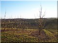
Living in HR7 4HZ means being part of a small, tightly knit residential cluster in England’s countryside. The area covers just 1.5 km², home to 1,626 residents, giving it a low population density of 33 people per square kilometre. This compact postcode area is characterised by a mature demographic, with a median age of 47 and a strong presence of adults aged 30–64. Daily life here is defined by quiet surroundings and a focus on stability, reflected in the high rate of home ownership (78%). The area lacks major urban infrastructure but offers a peaceful alternative for those prioritising space and safety. Residents benefit from a low crime risk, with a safety score of 78, and no significant environmental hazards like flood zones or protected natural sites. While the area is small, it is well-connected to nearby amenities, including retail outlets and a special needs school. For buyers seeking a low-maintenance, family-friendly environment with minimal planning constraints, HR7 4HZ provides a straightforward, practical option.
- Area Type
- Postcode
- Area Size
- 1.5 km²
- Population
- 1626
- Population Density
- 33 people/km²
The property market in HR7 4HZ is dominated by owner-occupied homes, with 78% of residents living in properties they own. This high rate of home ownership suggests a stable market with long-term residents rather than a transient rental economy. The area is primarily composed of houses, which is typical of smaller rural postcodes where larger properties are more common. Given the area’s size (1.5 km²) and low population density, the housing stock is likely limited to a small number of individual properties. For buyers, this means a niche market with fewer options but potentially more characterful homes. The lack of planning constraints such as AONB or protected woodlands may also make the area more attractive for those seeking to renovate or extend properties. However, the small size of the postcode means that buyers may need to look beyond immediate surroundings for a broader selection of homes.
House Prices in HR7 4HZ
Showing 11 properties
| Address | Type | Beds | Baths | Last Sale Price | Last Sale Date | |
|---|---|---|---|---|---|---|
| Vincenzo, Bromtrees Lane, Stoke Lacy, HR7 4HZ | Detached | 3 | 2 | £516,500 | Jun 2022 | |
| Green Acre, Bromtrees Lane, Stoke Lacy, HR7 4HZ | Bungalow | - | - | £153,000 | Jun 2021 | |
| Hopes Rough Cottage, Bromtrees Lane, Stoke Lacy, HR7 4HZ | Detached | 3 | - | £235,000 | May 2013 | |
| Heatherdown, Bromtrees Lane, Stoke Lacy, HR7 4HZ | Detached | - | - | £220,000 | Jul 2004 | |
| Orchard View, Bromtrees Lane, Stoke Lacy, HR7 4HZ | Bungalow | - | - | - | - | |
| Birches Farm, Bromtrees Lane, Stoke Lacy, HR7 4HZ | Detached | - | - | - | - | |
| Bromtrees Hall, Bromtrees Lane, Stoke Lacy, HR7 4HZ | storage_distribution | - | - | - | - | |
| Hopbine, Bromtrees Lane, Stoke Lacy, HR7 4HZ | Bungalow | - | - | - | - | |
| Hopes Rough Farm, Bromtrees Lane, Stoke Lacy, HR7 4HZ | house | - | - | - | - | |
| Farm View Bungalow, Bromtrees Lane, Stoke Lacy, HR7 4HZ | Bungalow | - | - | - | - |
Energy Efficiency in HR7 4HZ
Residents of HR7 4HZ have access to a modest selection of retail amenities within practical reach. The area includes four retail outlets, among them Spar, Morrisons Daily Bromyard, and Co-op Bromyard, providing essential shopping options for daily needs. These stores offer a range of products, from groceries to household items, supporting a convenient lifestyle without requiring long commutes. While the data does not list additional amenities such as parks or leisure facilities, the presence of these retail outlets suggests a focus on practicality and self-sufficiency. The low population density and small size of the postcode mean that social and recreational activities may be limited to nearby towns, but the available shops contribute to a sense of community and ease in managing daily life.
Amenities
Schools
The nearest school to HR7 4HZ is Compass Community School Hereford, a special school with a good Ofsted rating. This institution caters to students with specific educational needs, offering tailored support and resources. The presence of a special school in the area indicates that HR7 4HZ is likely to attract families with children requiring additional educational provisions. While no other schools are listed in the data, the availability of a high-quality special school suggests that the area is well-served for families with particular needs. However, those requiring mainstream education may need to look further afield, as the data does not include primary or secondary schools in the immediate vicinity.
| Rank | School | Type | Entry gender | Ages |
|---|
Explore more schools in this area
Go to Schools tabDemographics
The community in HR7 4HZ is predominantly composed of adults aged 30–64, with a median age of 47. This suggests a population skewed towards middle-aged individuals, likely with established careers and families. Home ownership is high at 78%, indicating a stable, long-term resident base rather than a transient rental market. The area is primarily composed of houses, which aligns with the demographic profile of older, settled households. The predominant ethnic group is White, reflecting a homogenous population. The low population density of 33 people per km² further underscores the rural, low-density nature of the area. While no specific data on deprivation is provided, the combination of high home ownership, low crime, and minimal environmental risks implies a relatively secure and stable quality of life. However, the absence of detailed diversity statistics means the community’s full composition remains partially unexplored.
Household Size
Accommodation Type
Tenure
Ethnic Group
Religion
Household Composition
Age
Household Deprivation
NS-SEC
Explore more demographic insights in this area
Go to Demographics tabPlanning
Planning Constraints
- Flood RiskPremium
- Ramsar Wetland SitesPremium
- Area of Outstanding Natural BeautyPremium
- Protected Nature ReservePremium
- Protected WoodlandPremium