Area Overview for HR7 4HA
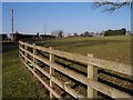
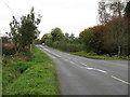
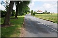
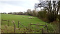
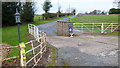
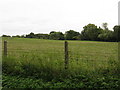
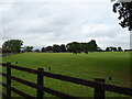
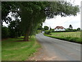
Photos of HR7 4HA

Area Information
HR7 4HA is a small, tightly knit residential postcode area in England, spanning just 1.4 km² and home to 1,437 people. With a population density of 29 people per square kilometre, it’s a quiet, low-density neighbourhood where community ties are likely strong. The area is characterised by its modest size, making it easy to navigate on foot or by bike. While not a bustling urban hub, it offers a peaceful, suburban lifestyle with a focus on local amenities. The demographic profile suggests a mature population, with a median age of 47 and the majority of residents falling within the 30–64 age range. This hints at a community of long-term residents, many of whom may be homeowners. Living in HR7 4HA means prioritising convenience over proximity to major cities, with daily life centred on nearby shops, schools, and the surrounding natural landscape. The area’s low flood risk and minimal planning constraints further support its appeal as a stable, low-maintenance place to live.
- Area Type
- Postcode
- Area Size
- 1.4 km²
- Population
- 1437
- Population Density
- 29 people/km²
The property market in HR7 4HA is dominated by owner-occupied homes, with 76% of residents living in properties they own. This high home ownership rate suggests a stable, long-term community with limited turnover in the housing stock. The accommodation type is primarily houses, which is typical for a low-density area. Given the small size of the postcode area—just 1.4 km²—there are likely only a handful of properties available, making the market compact and potentially competitive for buyers. The focus on owner-occupied housing indicates that rental properties are not a significant feature here, though the data does not specify the proportion of rental homes. For buyers, this means a limited selection of homes, often in a suburban or semi-rural setting. The area’s small size also means that property prices may be influenced more by local factors, such as proximity to schools or amenities, than by broader regional trends.
House Prices in HR7 4HA
Showing 8 properties
Energy Efficiency in HR7 4HA
The lifestyle in HR7 4HA is shaped by its proximity to local retail and community hubs. Within practical reach, residents have access to four retail outlets, including Morrisons Daily Bromyard and two Co-op stores in Bromyard. These shops provide essential services, from grocery shopping to everyday supplies, reducing the need for long trips to larger towns. While the data does not mention dining options, parks, or leisure facilities, the presence of multiple retail stores suggests a functional, community-focused approach to daily life. The area’s low density and small size mean that amenities are likely spread out, requiring some travel for specialized services. However, the availability of nearby shops and the potential for local events or social gatherings in Bromyard may contribute to a sense of convenience and connection. For those who value self-sufficiency and a slower pace of life, HR7 4HA offers a mix of practicality and quiet living, with local retail options forming the backbone of daily routines.
Amenities
Schools
Residents of HR7 4HA have access to two primary schools within practical reach: Burley Gate CofE Primary School and Pencombe CofE Primary School. Pencombe CofE Primary School holds an Ofsted rating of 'good', indicating a satisfactory standard of education. Both schools are likely to serve the local community, providing primary education for children in the area. The presence of two primary schools suggests that families have options, though the data does not mention secondary schools or other educational institutions. For parents, this means a focus on primary education, with the quality of Pencombe’s school offering reassurance. However, the absence of secondary school data means that families may need to consider commuting to nearby towns for secondary education. The mix of school types—both being primary—aligns with the area’s demographic profile, which includes a significant number of adults in the 30–64 age range, many of whom may have children in primary education.
| Rank | School | Type | Entry gender | Ages |
|---|
Explore more schools in this area
Go to Schools tabDemographics
The community in HR7 4HA is predominantly composed of adults aged 30–64, with a median age of 47. This suggests a mature, established population, likely with strong family ties and long-term residency. Home ownership is high, at 76%, indicating that most residents live in properties they own rather than renting. The accommodation type is primarily houses, which aligns with the area’s low density and suburban character. The predominant ethnic group is White, though no specific diversity statistics are provided. The age profile implies a balance between active professionals and retirees, with fewer young families or students. The low population density of 29 people per km² means the area is not overcrowded, offering more space per resident. This demographic mix may contribute to a quiet, stable environment where local amenities and services cater to a mix of needs, from school-aged children to older adults.
Household Size
Accommodation Type
Tenure
Ethnic Group
Religion
Household Composition
Age
Household Deprivation
NS-SEC
Explore more demographic insights in this area
Go to Demographics tabPlanning
Planning Constraints
- Flood RiskPremium
- Ramsar Wetland SitesPremium
- Area of Outstanding Natural BeautyPremium
- Protected Nature ReservePremium
- Protected WoodlandPremium