Area Overview for HR7 4AJ
Photos of HR7 4AJ
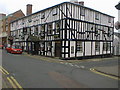
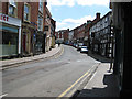
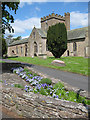
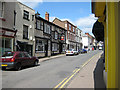

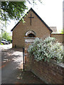
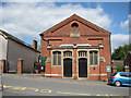
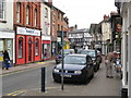
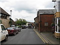

100 photos from this area
Area Information
Key information about the HR7 4AJ including its size, population, and administrative classification.
- Area Type
- Postcode
- Area Size
- 2.0 hectares
- Population
- 1696
- Population Density
- 2510 people/km²
House Prices in HR7 4AJ
42
Properties
£195,150
Average Sold Price
£47,000
Lowest Price
£435,000
Highest Price
Showing 42 properties
| Address | Type | Beds | Baths | Last Sale Price | Last Sale Date | |
|---|---|---|---|---|---|---|
| Rockland, 48 New Road, Bromyard, HR7 4AJ | Semi-detached | 5 | 2 | £435,000 | Jun 2025 | |
| 17 New Road, Bromyard, HR7 4AJ | house | - | - | £240,000 | Aug 2022 | |
| 52 New Road, Bromyard, HR7 4AJ | house | - | - | £357,000 | Jun 2021 | |
| 36-38 New Road, Bromyard, HR7 4AJ | house | - | - | £271,250 | Sep 2019 | |
| Baynham House, 22 New Road, Bromyard, HR7 4AJ | house | - | - | £230,000 | Jun 2019 | |
| The Lilacs, 12 New Road, Bromyard, HR7 4AJ | Terraced | 3 | 1 | £155,000 | Nov 2017 | |
| 56 New Road, Bromyard, HR7 4AJ | Semi-detached | 5 | 2 | £220,000 | Apr 2017 | |
| Kirkbrae, 50 New Road, Bromyard, HR7 4AJ | Semi-detached | 6 | 1 | £235,000 | Sep 2016 | |
| Mount Pleasant, 54 New Road, Bromyard, HR7 4AJ | Semi-detached | - | - | £160,000 | Aug 2011 | |
| 28 New Road, Bromyard, HR7 4AJ | house | 4 | 1 | £150,000 | Dec 2008 |
Page 1 of 5
Energy Efficiency in HR7 4AJ
Amenities
Schools
| Rank | School | Type | Entry gender | Ages |
|---|
Explore more schools in this area
Go to Schools tabDemographics
Household Size
One person
most common
Accommodation Type
Houses
most common
Tenure
42
majority
Ethnic Group
White
most common
Religion
N/A
most common
Household Composition
N/A
most common
Age
47
median
Adults (30-64 years)
most common
Household Deprivation
N/A
with no deprivation
NS-SEC
21
in Lower managerial occupations
Explore more demographic insights in this area
Go to Demographics tabPlanning
Planning Constraints
- Flood RiskPremium
- Ramsar Wetland SitesPremium
- Area of Outstanding Natural BeautyPremium
- Protected Nature ReservePremium
- Protected WoodlandPremium