Area Overview for HR6 9WD
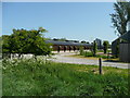
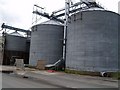
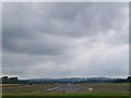
Photos of HR6 9WD


Area Information
Living in HR6 9WD offers a quiet, compact residential experience in a small cluster of homes spread across 3.0 hectares. With a population of 1,695 and a low density of 51 people per square kilometre, the area feels uncluttered, ideal for those seeking a slower pace of life. The community is predominantly composed of adults aged 30–64, suggesting a mix of established families and professionals. Daily life here is shaped by proximity to essential amenities, including four retail outlets such as Morrisons Leominster and Co-op Leominster, within practical reach. The area’s appeal lies in its balance of modest convenience and a sense of seclusion, though buyers should note the critical flood risk assessment, which highlights the need for careful consideration of property location and drainage infrastructure.
- Area Type
- Postcode
- Area Size
- 3.0 hectares
- Population
- 1695
- Population Density
- 51 people/km²
The property market in HR6 9WD is characterised by a high rate of home ownership (70%) and a focus on houses rather than flats or apartments. This suggests a market skewed towards owner-occupiers, likely families or professionals seeking stability. The small area size and limited number of properties mean the housing stock is finite, which could lead to competition among buyers. The absence of rental properties implies that the area may not cater to transient populations, making it more suitable for those planning long-term stays. For buyers, the compact nature of the area means proximity to amenities is a key advantage, though the critical flood risk assessment should be factored into property evaluations.
House Prices in HR6 9WD
Showing 1 properties
| Address | Type | Beds | Baths | Last Sale Price | Last Sale Date | |
|---|---|---|---|---|---|---|
| Shobdon Football Club, Shobdon Airfield Access, Shobdon, HR6 9WD | Leisure | - | - | - | - |
Energy Efficiency in HR6 9WD
Residents of HR6 9WD benefit from nearby retail amenities, including Morrisons Leominster, Co-op Leominster, and Aldi Leominster, which provide everyday shopping needs. These stores offer a range of products, from groceries to household items, ensuring convenience for daily life. While the data does not specify parks or leisure facilities, the proximity to retail hubs suggests a practical, community-focused lifestyle. The area’s compact nature means amenities are within walking or short driving distance, supporting a low-stress, accessible way of living.
Amenities
Schools
Residents of HR6 9WD have access to a range of educational options, including Shobdon Primary School, which holds a ‘good’ Ofsted rating, and Pembridge CofE Primary School, rated ‘outstanding’. Both are state-funded primary schools, offering high-quality education with strong performance indicators. For families seeking independent schooling, Grange House School is available, though it is listed twice in the data. The mix of state and independent institutions provides flexibility, allowing parents to choose between public and private education. This diversity ensures that families can align their choices with their priorities, whether focusing on affordability, academic standards, or specific curricula.
| Rank | School | Type | Entry gender | Ages |
|---|
Explore more schools in this area
Go to Schools tabDemographics
The population of HR6 9WD is 1,695, with a median age of 47 and the most common age group being adults aged 30–64. This suggests a mature, stable community with a focus on long-term residency. Home ownership is high at 70%, indicating a strong presence of owner-occupied properties rather than rental homes. The accommodation type is predominantly houses, reflecting a traditional housing stock that may appeal to families seeking space. The predominant ethnic group is White, and no specific deprivation data is provided, though the low population density and high home ownership suggest a relatively affluent, settled demographic.
Household Size
Accommodation Type
Tenure
Ethnic Group
Religion
Household Composition
Age
Household Deprivation
NS-SEC
Explore more demographic insights in this area
Go to Demographics tabPlanning
Planning Constraints
- Flood RiskPremium
- Ramsar Wetland SitesPremium
- Area of Outstanding Natural BeautyPremium
- Protected Nature ReservePremium
- Protected WoodlandPremium