Area Overview for HR6 9QY
Photos of HR6 9QY
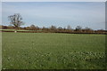
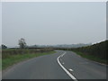
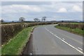
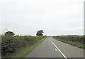
5 photos from this area
Area Information
Key information about the HR6 9QY including its size, population, and administrative classification.
- Area Type
- Postcode
- Area Size
- 45.6 hectares
- Population
- 1539
- Population Density
- 363 people/km²
House Prices in HR6 9QY
16
Properties
£482,000
Average Sold Price
£159,000
Lowest Price
£1,110,000
Highest Price
Showing 16 properties
| Address | Type | Beds | Baths | Last Sale Price | Last Sale Date | |
|---|---|---|---|---|---|---|
| China Hall, B 4360 Kingsland To Cholstrey Road Via Cobnash, Kingsland, HR6 9QY | house | 4 | 2 | £1,110,000 | Apr 2023 | |
| Cobnash House, Hostel Lane, Cobnash Kingsland, HR6 9QY | Retail | 5 | 2 | £753,000 | Dec 2022 | |
| Merrywold, C 1037 Cobnash To Lawton Road, Cobnash Kingsland, HR6 9QY | house | - | - | £159,000 | Dec 2017 | |
| The Old Cottage, B 4360 Kingsland To Cholstrey Road Via Cobnash, Kingsland, HR6 9QY | house | - | - | £360,000 | Jul 2016 | |
| Yew Tree Cottage, B 4360 Kingsland To Cholstrey Road Via Cobnash, Kingsland, HR6 9QY | house | 3 | 1 | £165,000 | Dec 2014 | |
| Bower Cottage, B 4360 Kingsland To Cholstrey Road Via Cobnash, Kingsland, HR6 9QY | house | - | - | £345,000 | May 2007 | |
| Penmill, B 4360 Kingsland To Cholstrey Road Via Cobnash, Kingsland, HR6 9QY | Detached | 4 | 2 | - | - | |
| Whitley Court, B 4360 Kingsland To Cholstrey Road Via Cobnash, Kingsland, HR6 9QY | Detached | 4 | - | - | - | |
| Westfield Farm, B 4360 Kingsland To Cholstrey Road Via Cobnash, Kingsland, HR6 9QY | house | - | - | - | - | |
| The Farm, B 4360 Kingsland To Cholstrey Road Via Cobnash, Kingsland, HR6 9QY | Detached | 3 | 1 | - | - |
Page 1 of 2
Energy Efficiency in HR6 9QY
Amenities
Schools
| Rank | School | Type | Entry gender | Ages |
|---|
Explore more schools in this area
Go to Schools tabDemographics
Household Size
Two person
most common
Accommodation Type
Houses
most common
Tenure
63
majority
Ethnic Group
White
most common
Religion
N/A
most common
Household Composition
N/A
most common
Age
47
median
Adults (30-64 years)
most common
Household Deprivation
N/A
with no deprivation
NS-SEC
25
in Lower managerial occupations
Explore more demographic insights in this area
Go to Demographics tabPlanning
Planning Constraints
- Flood RiskPremium
- Ramsar Wetland SitesPremium
- Area of Outstanding Natural BeautyPremium
- Protected Nature ReservePremium
- Protected WoodlandPremium