Area Overview for HR6 9PA
Photos of HR6 9PA

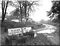
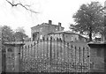
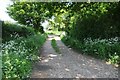
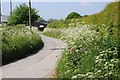
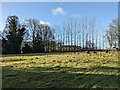

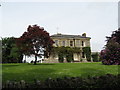
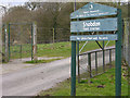

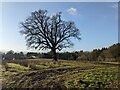
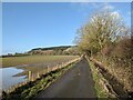
14 photos from this area
Area Information
Key information about the HR6 9PA including its size, population, and administrative classification.
- Area Type
- Postcode
- Area Size
- 77.9 hectares
- Population
- 1695
- Population Density
- 51 people/km²
House Prices in HR6 9PA
20
Properties
£700,000
Average Sold Price
£250,000
Lowest Price
£1,575,000
Highest Price
Showing 20 properties
| Address | Type | Beds | Baths | Last Sale Price | Last Sale Date | |
|---|---|---|---|---|---|---|
| Uphampton House, Belgate Lane, Uphampton Shobdon, HR6 9PA | Detached | 5 | 4 | £1,575,000 | Dec 2022 | |
| The Old Smithy, Belgate Lane, Uphampton Shobdon, HR6 9PA | house | - | - | £250,000 | Oct 2012 | |
| Well House, Belgate Lane, Uphampton Shobdon, HR6 9PA | Bungalow | - | - | £275,000 | Jan 2009 | |
| Uphampton Farm, Belgate Lane, Uphampton Shobdon, HR6 9PA | house | 6 | - | - | - | |
| Annexe, Four Oaks, Belgate Lane, Uphampton Shobdon, HR6 9PA | Semi-detached | - | - | - | - | |
| Plot 1 Land At Uphampton Farm Proposed Erection Of Agricultural Workers Dwelling, Belgate Lane, Uphampton Shobdon, HR6 9PA | Detached | - | - | - | - | |
| Woodlands, Uphampton Farm, Belgate Lane, Uphampton Shobdon, HR6 9PA | Detached | - | - | - | - | |
| Plot 1 Land At Uphampton House Change Of Use Of Workshop And Swimming Pool To Dwelling, Belgate Lane, Uphampton Shobdon, HR6 9PA | Semi-detached | - | - | - | - | |
| Mobile Home, Uphampton Farm, Belgate Lane, Uphampton Shobdon, HR6 9PA | Mobile Home | - | - | - | - | |
| New Property Near The Boozie Uphampton, Belgate Lane, Uphampton Shobdon, HR6 9PA | Detached | - | - | - | - |
Page 1 of 2
Energy Efficiency in HR6 9PA
Amenities
Schools
| Rank | School | Type | Entry gender | Ages |
|---|
Explore more schools in this area
Go to Schools tabDemographics
Household Size
Two person
most common
Accommodation Type
Houses
most common
Tenure
70
majority
Ethnic Group
White
most common
Religion
N/A
most common
Household Composition
N/A
most common
Age
47
median
Adults (30-64 years)
most common
Household Deprivation
N/A
with no deprivation
NS-SEC
34
in Lower managerial occupations
Explore more demographic insights in this area
Go to Demographics tabPlanning
Planning Constraints
- Flood RiskPremium
- Ramsar Wetland SitesPremium
- Area of Outstanding Natural BeautyPremium
- Protected Nature ReservePremium
- Protected WoodlandPremium