Area Overview for HR6 9NL
Photos of HR6 9NL
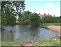
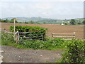
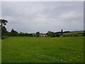
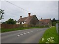
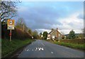
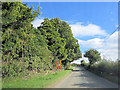
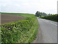
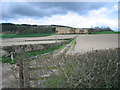

10 photos from this area
Area Information
Key information about the HR6 9NL including its size, population, and administrative classification.
- Area Type
- Postcode
- Area Size
- 61.7 hectares
- Population
- 1695
- Population Density
- 51 people/km²
House Prices in HR6 9NL
9
Properties
£342,500
Average Sold Price
£275,000
Lowest Price
£410,000
Highest Price
Showing 9 properties
| Address | Type | Beds | Baths | Last Sale Price | Last Sale Date | |
|---|---|---|---|---|---|---|
| Oak Barn, B 4362 From C 1023 To Presteigne Road, Shobdon, HR6 9NL | Semi-detached | 3 | 2 | £410,000 | Nov 2024 | |
| The Hayloft, B 4362 From C 1023 To Presteigne Road, Shobdon, HR6 9NL | house | - | - | £275,000 | Oct 2011 | |
| 1, Lower Woodhouse, B 4362 From C 1023 To Presteigne Road, Shobdon, HR6 9NL | Retail | 2 | 1 | - | - | |
| Woodside, B 4362 From Presteigne Road To Covenhope Lane, Shobdon, HR6 9NL | Land | - | - | - | - | |
| Little Woodhouse, B 4362 From C 1023 To Presteigne Road, Shobdon, HR6 9NL | house | - | - | - | - | |
| The Malthouse, B 4362 From C 1023 To Presteigne Road, Shobdon, HR6 9NL | Detached | - | - | - | - | |
| Woodhouse Farm, B 4362 From C 1023 To Presteigne Road, Shobdon, HR6 9NL | house | - | - | - | - | |
| Min Y Dwr, Lower Woodhouse, B 4362 From C 1023 To Presteigne Road, Shobdon, HR6 9NL | Semi-detached | - | - | - | - | |
| Lammas Cottage, Lower Woodhouse, B 4362 From C 1023 To Presteigne Road, Shobdon, HR6 9NL | Detached | - | - | - | - |
Energy Efficiency in HR6 9NL
Amenities
Schools
| Rank | School | Type | Entry gender | Ages |
|---|
Explore more schools in this area
Go to Schools tabDemographics
Household Size
Two person
most common
Accommodation Type
Houses
most common
Tenure
70
majority
Ethnic Group
White
most common
Religion
N/A
most common
Household Composition
N/A
most common
Age
47
median
Adults (30-64 years)
most common
Household Deprivation
N/A
with no deprivation
NS-SEC
34
in Lower managerial occupations
Explore more demographic insights in this area
Go to Demographics tabPlanning
Planning Constraints
- Flood RiskPremium
- Ramsar Wetland SitesPremium
- Area of Outstanding Natural BeautyPremium
- Protected Nature ReservePremium
- Protected WoodlandPremium