Area Overview for HR6 9JA
Photos of HR6 9JA

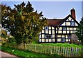
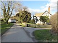
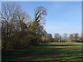
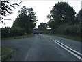
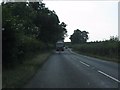
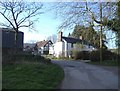
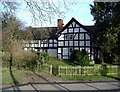
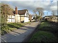
11 photos from this area
Area Information
Key information about the HR6 9JA including its size, population, and administrative classification.
- Area Type
- Postcode
- Area Size
- 96.1 hectares
- Population
- 1695
- Population Density
- 51 people/km²
House Prices in HR6 9JA
16
Properties
£429,417
Average Sold Price
£60,000
Lowest Price
£887,500
Highest Price
Showing 16 properties
| Address | Type | Beds | Baths | Last Sale Price | Last Sale Date | |
|---|---|---|---|---|---|---|
| Yew Tree House, Marston Lane, Pembridge, HR6 9JA | Detached | - | - | £650,000 | Aug 2021 | |
| Grange Farm, Marston Lane, Pembridge, HR6 9JA | Semi-detached | - | - | £887,500 | Mar 2021 | |
| 2, Marstondale, Marston Lane, Pembridge, HR6 9JA | house | - | - | £312,000 | Feb 2021 | |
| The Post House, Marston Lane From A 44 To C 1031, Pembridge, HR6 9JA | Detached | 5 | 3 | £542,000 | Dec 2012 | |
| Ty Gwenllian, Marston Lane, Pembridge, HR6 9JA | Detached | - | - | £60,000 | Oct 1996 | |
| Marston House, Marston Lane, Pembridge, HR6 9JA | Detached | 7 | 1 | £125,000 | Mar 1995 | |
| The Blacksmith Shop Marston, Marston Lane, Pembridge, HR6 9JA | Detached | 4 | - | - | - | |
| The Green, Marston Court, Marston Lane, Pembridge, HR6 9JA | Semi-detached | - | - | - | - | |
| Mobile Home, Ty Gwenllian, Marston Lane, Pembridge, HR6 9JA | Mobile Home | - | - | - | - | |
| Marston View, Marston Court, Marston Lane, Pembridge, HR6 9JA | Semi-detached | - | - | - | - |
Page 1 of 2
Energy Efficiency in HR6 9JA
Amenities
Schools
| Rank | School | Type | Entry gender | Ages |
|---|
Explore more schools in this area
Go to Schools tabDemographics
Household Size
Two person
most common
Accommodation Type
Houses
most common
Tenure
70
majority
Ethnic Group
White
most common
Religion
N/A
most common
Household Composition
N/A
most common
Age
47
median
Adults (30-64 years)
most common
Household Deprivation
N/A
with no deprivation
NS-SEC
34
in Lower managerial occupations
Explore more demographic insights in this area
Go to Demographics tabPlanning
Planning Constraints
- Flood RiskPremium
- Ramsar Wetland SitesPremium
- Area of Outstanding Natural BeautyPremium
- Protected Nature ReservePremium
- Protected WoodlandPremium