Area Overview for HR6 8HD
Photos of HR6 8HD
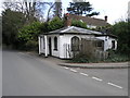

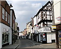
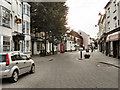
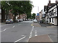
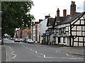
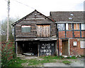
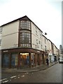
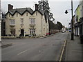
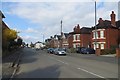
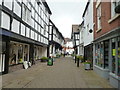
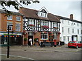
100 photos from this area
Area Information
Key information about the HR6 8HD including its size, population, and administrative classification.
- Area Type
- Postcode
- Area Size
- 1.5 hectares
- Population
- 1452
- Population Density
- 3597 people/km²
House Prices in HR6 8HD
24
Properties
£195,050
Average Sold Price
£40,000
Lowest Price
£425,000
Highest Price
Showing 24 properties
| Address | Type | Beds | Baths | Last Sale Price | Last Sale Date | |
|---|---|---|---|---|---|---|
| Samrose, 22 Westfield Walk, Leominster, HR6 8HD | Detached | 4 | 3 | £425,000 | Dec 2023 | |
| 13 Westfield Walk, Leominster, HR6 8HD | Terraced | 3 | 1 | £170,000 | Nov 2023 | |
| Radnor Barn, Bargates, Leominster, HR6 8HD | Cottage | 2 | 1 | £190,000 | Nov 2022 | |
| Halleys, 24 Westfield Walk, Leominster, HR6 8HD | Bungalow | - | - | £345,000 | Jul 2022 | |
| 2 Westfield Walk, Leominster, HR6 8HD | Semi-detached | 3 | - | £185,000 | Aug 2019 | |
| 12 Westfield Walk, Leominster, HR6 8HD | Terraced | 3 | 2 | £149,950 | Jun 2014 | |
| 16 Westfield Walk, Leominster, HR6 8HD | Terraced | - | - | £191,000 | Jun 2007 | |
| 18 Westfield Walk, Leominster, HR6 8HD | Semi-detached | - | - | £59,500 | Nov 1997 | |
| 6 Westfield Walk, Leominster, HR6 8HD | Semi-detached | 3 | 1 | £40,000 | Jan 1996 | |
| 3 Westfield Walk, Leominster, HR6 8HD | Cottage | 2 | 1 | - | - |
Page 1 of 3
Energy Efficiency in HR6 8HD
Amenities
Schools
| Rank | School | Type | Entry gender | Ages |
|---|
Explore more schools in this area
Go to Schools tabDemographics
Household Size
One person
most common
Accommodation Type
Houses
most common
Tenure
52
majority
Ethnic Group
White
most common
Religion
N/A
most common
Household Composition
N/A
most common
Age
47
median
Adults (30-64 years)
most common
Household Deprivation
N/A
with no deprivation
NS-SEC
19
in Lower managerial occupations
Explore more demographic insights in this area
Go to Demographics tabPlanning
Planning Constraints
- Flood RiskPremium
- Ramsar Wetland SitesPremium
- Area of Outstanding Natural BeautyPremium
- Protected Nature ReservePremium
- Protected WoodlandPremium