Area Overview for HR6 8EB
Photos of HR6 8EB
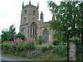
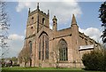
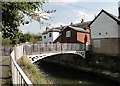
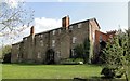
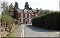
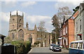
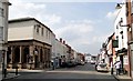
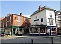
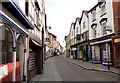
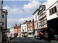
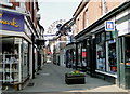
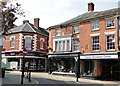
100 photos from this area
Area Information
Key information about the HR6 8EB including its size, population, and administrative classification.
- Area Type
- Postcode
- Area Size
- 7096 m²
- Population
- 1602
- Population Density
- 950 people/km²
House Prices in HR6 8EB
20
Properties
£118,692
Average Sold Price
£30,000
Lowest Price
£336,000
Highest Price
Showing 20 properties
| Address | Type | Beds | Baths | Last Sale Price | Last Sale Date | |
|---|---|---|---|---|---|---|
| 9 Mill Street, Leominster, HR6 8EB | Cottage | 2 | 1 | £130,000 | Sep 2022 | |
| 27 Mill Street, Leominster, HR6 8EB | Terraced | 4 | - | £336,000 | Dec 2021 | |
| 17 Mill Street, Leominster, HR6 8EB | house | - | - | £120,000 | Oct 2019 | |
| The Cruck House, 45 Mill Street, Leominster, HR6 8EB | Terraced | 2 | - | £106,000 | May 2018 | |
| 11 Mill Street, Leominster, HR6 8EB | Terraced | 3 | 1 | £155,000 | Oct 2016 | |
| 55 Mill Street, Leominster, HR6 8EB | Cottage | 2 | 1 | £103,000 | Jan 2015 | |
| 5 Mill Street, Leominster, HR6 8EB | house | - | - | £80,000 | Jan 2011 | |
| 31 Mill Street, Leominster, HR6 8EB | Terraced | - | - | £169,000 | Nov 2006 | |
| 29 Mill Street, Leominster, HR6 8EB | Terraced | 3 | 1 | £122,500 | Feb 2004 | |
| 15 Mill Street, Leominster, HR6 8EB | Semi-detached | - | - | £30,000 | Nov 2001 |
Page 1 of 2
Energy Efficiency in HR6 8EB
Amenities
Schools
| Rank | School | Type | Entry gender | Ages |
|---|
Explore more schools in this area
Go to Schools tabDemographics
Household Size
Family (3-5 people)
most common
Accommodation Type
Houses
most common
Tenure
36
majority
Ethnic Group
White
most common
Religion
N/A
most common
Household Composition
N/A
most common
Age
47
median
Adults (30-64 years)
most common
Household Deprivation
N/A
with no deprivation
NS-SEC
20
in Lower managerial occupations
Explore more demographic insights in this area
Go to Demographics tabPlanning
Planning Constraints
- Flood RiskPremium
- Ramsar Wetland SitesPremium
- Area of Outstanding Natural BeautyPremium
- Protected Nature ReservePremium
- Protected WoodlandPremium