Area Overview for HR6 8AE
Photos of HR6 8AE
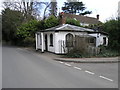

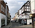
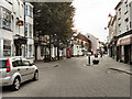
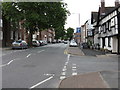
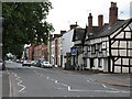
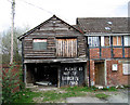
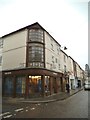
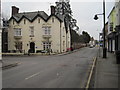
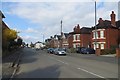
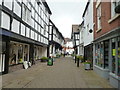
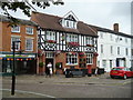
100 photos from this area
Area Information
Key information about the HR6 8AE including its size, population, and administrative classification.
- Area Type
- Postcode
- Area Size
- 1.8 hectares
- Population
- 1650
- Population Density
- 2757 people/km²
House Prices in HR6 8AE
48
Properties
£154,615
Average Sold Price
£55,000
Lowest Price
£325,000
Highest Price
Showing 48 properties
| Address | Type | Beds | Baths | Last Sale Price | Last Sale Date | |
|---|---|---|---|---|---|---|
| 55 Etnam Street, Leominster, HR6 8AE | Terraced | 3 | 1 | £200,000 | Jun 2025 | |
| 81 Etnam Street, Leominster, HR6 8AE | Terraced | - | - | £185,000 | Aug 2021 | |
| 4, Grange House, The Grange, Leominster, HR6 8AE | house | - | - | £265,000 | Jan 2021 | |
| 51 Etnam Street, Leominster, HR6 8AE | Terraced | 3 | 2 | £222,000 | Dec 2020 | |
| 47 Etnam Street, Leominster, HR6 8AE | Semi-detached | 5 | 2 | £325,000 | Oct 2020 | |
| 53 Etnam Street, Leominster, HR6 8AE | house | - | - | £200,000 | Nov 2017 | |
| 37 Etnam Street, Leominster, HR6 8AE | Terraced | - | - | £140,000 | Aug 2004 | |
| 77 Etnam Street, Leominster, HR6 8AE | Terraced | - | - | £106,000 | Feb 2004 | |
| Aurora, 79 Etnam Street, Leominster, HR6 8AE | Terraced | - | - | £118,000 | Jun 2003 | |
| 67 Etnam Street, Leominster, HR6 8AE | house | 3 | - | £62,000 | Jun 2001 |
Page 1 of 5
Energy Efficiency in HR6 8AE
Amenities
Schools
| Rank | School | Type | Entry gender | Ages |
|---|
Explore more schools in this area
Go to Schools tabDemographics
Household Size
One person
most common
Accommodation Type
Houses
most common
Tenure
32
majority
Ethnic Group
White
most common
Religion
N/A
most common
Household Composition
N/A
most common
Age
47
median
Adults (30-64 years)
most common
Household Deprivation
N/A
with no deprivation
NS-SEC
19
in Lower managerial occupations
Explore more demographic insights in this area
Go to Demographics tabPlanning
Planning Constraints
- Flood RiskPremium
- Ramsar Wetland SitesPremium
- Area of Outstanding Natural BeautyPremium
- Protected Nature ReservePremium
- Protected WoodlandPremium