Area Overview for HR6 0SP
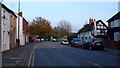
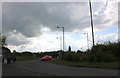
Photos of HR6 0SP


Area Information
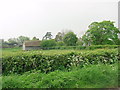
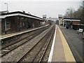
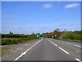
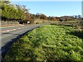
HR6 0SP is a small, tightly defined residential postcode area in England, covering just 6,849 square metres and home to 1,637 residents. Its compact size and low population density of 118 people per square kilometre suggest a quiet, low-density living environment. The area is characterised by its focus on single-family homes, with a population skewed toward adults aged 30–64, reflecting a community of established professionals and families. While it lacks the sprawling infrastructure of larger towns, its proximity to Leominster Railway Station and nearby retail hubs like Aldi, Co-op, and Morrisons offers practical connectivity for daily needs. The area’s small footprint means it is likely surrounded by open land or rural settings, though specific details about surrounding geography are not provided. For those seeking a peaceful, community-oriented lifestyle with easy access to essential services, HR6 0SP may appeal, though its limited size means it is not suited for those requiring extensive amenities or a larger social network.
- Area Type
- Postcode
- Area Size
- 6849 m²
- Population
- 1637
- Population Density
- 118 people/km²
HR6 0SP is a predominantly owner-occupied area, with 65% of residents living in properties they own. The housing stock is almost entirely composed of houses, which is typical of smaller, rural or semi-rural postcode areas. This suggests a community where long-term residency is the norm, with limited turnover in the property market. The small size of the area—just 6,849 square metres—means the housing stock is likely limited to a handful of properties, potentially making it a niche market for buyers seeking a quiet, low-density environment. The focus on single-family homes may appeal to those prioritising space and privacy over proximity to urban centres. However, the limited number of properties could also mean fewer options for buyers, requiring careful consideration of local planning constraints and the area’s proximity to larger towns for additional amenities.
House Prices in HR6 0SP
No properties found in this postcode.
Energy Efficiency in HR6 0SP
Residents of HR6 0SP have access to essential retail amenities within practical reach, including Aldi, Co-op, and Morrisons in Leominster. These stores provide a range of everyday goods, reducing the need for long trips to larger centres. The nearby Leominster Railway Station offers connectivity to regional destinations, though the area itself lacks larger leisure or entertainment facilities. The absence of named parks, dining venues, or cultural attractions suggests that daily life here is focused on practicality and proximity to services. For those prioritising convenience and a low-maintenance lifestyle, the availability of basic retail and transport options is a key advantage. However, the area’s limited size and amenities may not satisfy those seeking a more vibrant social or recreational environment.
Amenities
Schools
| Rank | School | Type | Entry gender | Ages |
|---|
Explore more schools in this area
Go to Schools tabDemographics
The population of HR6 0SP is predominantly adults aged 30–64, with a median age of 47. This suggests a mature, stable community with a strong presence of middle-aged professionals and families. Home ownership is high at 65%, indicating a preference for long-term residency over rental properties. The area is composed almost entirely of houses, reflecting a traditional, suburban housing stock. The predominant ethnic group is White, though no data is available on the proportion of other ethnicities. With a population density of 118 people per square kilometre, the area is sparsely populated, offering a sense of space and privacy. The absence of specific data on deprivation or income levels means it is difficult to assess the area’s economic challenges, but the high home ownership rate and age profile suggest a generally stable, middle-income demographic.
Household Size
Accommodation Type
Tenure
Ethnic Group
Religion
Household Composition
Age
Household Deprivation
NS-SEC
Explore more demographic insights in this area
Go to Demographics tabPlanning
Planning Constraints
- Flood RiskPremium
- Ramsar Wetland SitesPremium
- Area of Outstanding Natural BeautyPremium
- Protected Nature ReservePremium
- Protected WoodlandPremium