Area Overview for HR6 0QH
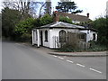
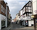
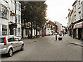
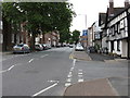
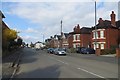
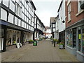
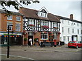
Photos of HR6 0QH

Area Information
Living in HR6 0QH means being part of a small, tightly knit residential cluster in England. The area covers 4180 square metres and is home to 1637 people, giving it a low population density of 118 people per square kilometre. This suggests a quiet, low-rise character, with homes spread across a manageable footprint. The community is predominantly composed of adults aged 30 to 64, with a median age of 47, indicating a mature, stable population. The area’s proximity to Leominster Railway Station and nearby retail outlets like Aldi, Co-op, and Morrisons offers practical convenience without the bustle of larger towns. Daily life here balances accessibility with a sense of seclusion, ideal for those seeking a quieter lifestyle. The presence of a single railway station and limited retail options reflects a small-scale, localised environment, where community ties are likely strong. For buyers, HR6 0QH represents a niche opportunity to own a home in a defined, low-density area with a clear demographic profile.
- Area Type
- Postcode
- Area Size
- 4180 m²
- Population
- 1637
- Population Density
- 118 people/km²
The property market in HR6 0QH is characterised by a high rate of home ownership (65%) and a focus on houses rather than flats or apartments. This suggests a market skewed towards owner-occupiers rather than renters, with properties likely to be family homes or long-term investments. Given the area’s small size and low population density, the housing stock is limited, which may make it a competitive market for buyers. The predominance of houses indicates a preference for private, spacious living, though the exact size or style of properties is not specified. For prospective buyers, this means a smaller selection of properties but potentially more individualised options. The low population density also implies that properties may be set further apart, offering privacy but requiring consideration of commuting distances. The market’s stability, supported by high ownership rates, could be appealing to those seeking a settled, low-maintenance lifestyle.
House Prices in HR6 0QH
Showing 1 properties
| Address | Type | Beds | Baths | Last Sale Price | Last Sale Date | |
|---|---|---|---|---|---|---|
| Bill Davies Atv, Bill Davies Atv Ltd, Southern Avenue, Leominster, HR6 0QH | general_industrial | - | - | - | - |
Energy Efficiency in HR6 0QH
The lifestyle in HR6 0QH is shaped by its proximity to essential amenities within practical reach. Leominster Railway Station offers direct access to regional travel, while nearby retail outlets like Aldi, Co-op, and Morrisons provide everyday shopping needs. These stores cater to a range of budgets and preferences, ensuring residents have access to basic provisions without needing to travel far. The absence of additional amenities such as parks, leisure facilities, or dining options suggests a focus on functional living rather than entertainment-driven lifestyles. For those prioritising convenience and practicality, the area’s amenities are sufficient for daily needs. However, the limited range of venues means residents may need to venture further for more diverse leisure activities. The character of HR6 0QH is one of simplicity, where local shops and transport links form the backbone of daily life.
Amenities
Schools
| Rank | School | Type | Entry gender | Ages |
|---|
Explore more schools in this area
Go to Schools tabDemographics
The community in HR6 0QH is defined by its age profile and home ownership rates. With a median age of 47, the area is dominated by adults in the 30-64 age range, suggesting a population focused on middle-aged and older residents. Home ownership is high at 65%, which aligns with the predominance of houses as the primary accommodation type. This indicates a stable, long-term resident base rather than a transient rental market. The predominant ethnic group is White, with no specific data on other demographics provided. The low population density of 118 people per square kilometre implies a less crowded, more spread-out living environment. This combination of age, ownership, and housing type suggests a community prioritising permanence and family-oriented living. The absence of detailed diversity data means the area’s social fabric is likely homogenous, which may influence local culture and social dynamics.
Household Size
Accommodation Type
Tenure
Ethnic Group
Religion
Household Composition
Age
Household Deprivation
NS-SEC
Explore more demographic insights in this area
Go to Demographics tabPlanning
Planning Constraints
- Flood RiskPremium
- Ramsar Wetland SitesPremium
- Area of Outstanding Natural BeautyPremium
- Protected Nature ReservePremium
- Protected WoodlandPremium