Area Overview for HR6 0PJ
Photos of HR6 0PJ
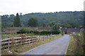
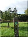
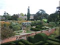
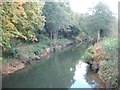
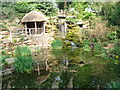
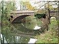
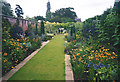
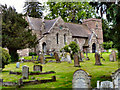
92 photos from this area
Area Information
Key information about the HR6 0PJ including its size, population, and administrative classification.
- Area Type
- Postcode
- Area Size
- 30.1 hectares
- Population
- 1516
- Population Density
- 46 people/km²
House Prices in HR6 0PJ
27
Properties
£225,000
Average Sold Price
£225,000
Lowest Price
£225,000
Highest Price
Showing 27 properties
| Address | Type | Beds | Baths | Last Sale Price | Last Sale Date | |
|---|---|---|---|---|---|---|
| Maythorne, A 49 From Marlbrook To Queenswood, Hope Under Dinmore, HR6 0PJ | house | - | - | £225,000 | Apr 2016 | |
| 5 Northside Park, Hope Under Dinmore, HR6 0PJ | Mobile Home | 2 | 1 | - | - | |
| The Old Post House, A 49 From Marlbrook To Queenswood, Hope Under Dinmore, HR6 0PJ | Retail | 4 | 2 | - | - | |
| The Old School, A 49 From Marlbrook To Queenswood, Hope Under Dinmore, HR6 0PJ | Semi-detached | - | - | - | - | |
| Plot 1 Site Of Former St Marys School Proposed New Dwellings, A 49 From Marlbrook To Queenswood, Hope Under Dinmore, HR6 0PJ | Detached | - | - | - | - | |
| Caravan At Site Of Former St Marys School, A 49 From Marlbrook To Queenswood, Hope Under Dinmore, HR6 0PJ | Mobile Home | - | - | - | - | |
| 2 Northside Park, Hope Under Dinmore, HR6 0PJ | park_home | - | - | - | - | |
| 13 Northside Park, Hope Under Dinmore, HR6 0PJ | Mobile Home | - | - | - | - | |
| 10 Northside Park, Hope Under Dinmore, HR6 0PJ | Mobile Home | - | - | - | - | |
| 6 Northside Park, Hope Under Dinmore, HR6 0PJ | park_home | - | - | - | - |
Page 1 of 3
Energy Efficiency in HR6 0PJ
Amenities
Schools
| Rank | School | Type | Entry gender | Ages |
|---|
Explore more schools in this area
Go to Schools tabDemographics
Household Size
Two person
most common
Accommodation Type
Houses
most common
Tenure
78
majority
Ethnic Group
White
most common
Religion
N/A
most common
Household Composition
N/A
most common
Age
47
median
Adults (30-64 years)
most common
Household Deprivation
N/A
with no deprivation
NS-SEC
37
in Lower managerial occupations
Explore more demographic insights in this area
Go to Demographics tabPlanning
Planning Constraints
- Flood RiskPremium
- Ramsar Wetland SitesPremium
- Area of Outstanding Natural BeautyPremium
- Protected Nature ReservePremium
- Protected WoodlandPremium