Area Overview for HR6 0HD
Photos of HR6 0HD


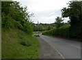
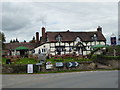
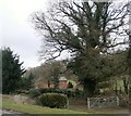
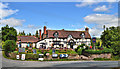
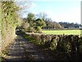
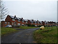
25 photos from this area
Area Information
Key information about the HR6 0HD including its size, population, and administrative classification.
- Area Type
- Postcode
- Area Size
- 4.2 hectares
- Population
- 1277
- Population Density
- 33 people/km²
House Prices in HR6 0HD
10
Properties
£307,811
Average Sold Price
£58,000
Lowest Price
£555,555
Highest Price
Showing 10 properties
| Address | Type | Beds | Baths | Last Sale Price | Last Sale Date | |
|---|---|---|---|---|---|---|
| Merchant House, Hamnish Road, Kimbolton, HR6 0HD | Detached | 4 | 1 | £445,000 | Oct 2022 | |
| Stockton Court Cottage, C 1049 Pateshall Lane, Kimbolton, HR6 0HD | house | - | - | £555,555 | Oct 2021 | |
| Steppes Cottage, New Road, Kimbolton, HR6 0HD | Detached | 3 | 1 | £310,000 | Oct 2006 | |
| Stockton Villa, C 1049 Pateshall Lane, Kimbolton, HR6 0HD | Bungalow | 3 | 1 | £170,500 | Apr 2001 | |
| Spice House, A 4112 From A 49 To Stockton Cross, Kimbolton, HR6 0HD | Detached | - | - | £58,000 | Feb 1996 | |
| Croftwell House, A 4112 From A 49 To Stockton Cross, Kimbolton, HR6 0HD | house | - | - | - | - | |
| Olde Shoppe Cottage, A 4112 From A 49 To Stockton Cross, Kimbolton, HR6 0HD | Detached | - | - | - | - | |
| Stockton Cross Inn, C 1049 Pateshall Lane, Kimbolton, HR6 0HD | restaurant_cafe | - | - | - | - | |
| 1 Maple Way, Kimbolton, HR6 0HD | Detached | - | - | - | - | |
| Managers Accommodation, Stockton Cross Inn, C 1049 Pateshall Lane, Kimbolton, HR6 0HD | Flat | - | - | - | - |
Energy Efficiency in HR6 0HD
Amenities
Schools
| Rank | School | Type | Entry gender | Ages |
|---|
Explore more schools in this area
Go to Schools tabDemographics
Household Size
Two person
most common
Accommodation Type
Houses
most common
Tenure
76
majority
Ethnic Group
White
most common
Religion
N/A
most common
Household Composition
N/A
most common
Age
47
median
Adults (30-64 years)
most common
Household Deprivation
N/A
with no deprivation
NS-SEC
37
in Lower managerial occupations
Explore more demographic insights in this area
Go to Demographics tabPlanning
Planning Constraints
- Flood RiskPremium
- Ramsar Wetland SitesPremium
- Area of Outstanding Natural BeautyPremium
- Protected Nature ReservePremium
- Protected WoodlandPremium