Area Overview for HR6 0AU
Photos of HR6 0AU
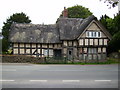
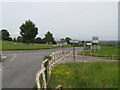
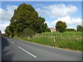
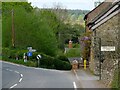
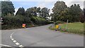
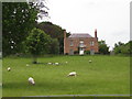
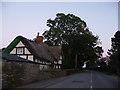
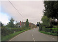
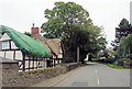
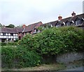
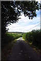
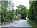
16 photos from this area
Area Information
Key information about the HR6 0AU including its size, population, and administrative classification.
- Area Type
- Postcode
- Area Size
- 5.4 hectares
- Population
- 1417
- Population Density
- 52 people/km²
House Prices in HR6 0AU
15
Properties
£328,500
Average Sold Price
£225,000
Lowest Price
£400,000
Highest Price
Showing 15 properties
| Address | Type | Beds | Baths | Last Sale Price | Last Sale Date | |
|---|---|---|---|---|---|---|
| Homelea, Access Road To The Old Barn, Bircher, HR6 0AU | Bungalow | 3 | 1 | £400,000 | Aug 2025 | |
| 1, Old Barn Court, B 4362 From Croft Lane To B 4361 Orleton, Bircher, HR6 0AU | house | 4 | 2 | £342,000 | May 2022 | |
| Orchard Cottage, Access Road To The Old Barn, Bircher, HR6 0AU | Detached | 3 | 1 | £372,500 | Jun 2021 | |
| The Cider Mill, Access Road To The Old Barn, Bircher, HR6 0AU | Detached | 3 | 2 | £365,000 | Sep 2017 | |
| 6, Old Barn Court, B 4362 From Croft Lane To B 4361 Orleton, Bircher, HR6 0AU | Semi-detached | 3 | 1 | £266,500 | Aug 2016 | |
| 3, Old Barn Court, B 4362 From Croft Lane To B 4361 Orleton, Bircher, HR6 0AU | Terraced | - | - | £225,000 | Mar 2004 | |
| 5, Timbers, Old Barn Court, B 4362 From Croft Lane To B 4361 Orleton, Bircher, HR6 0AU | house | 4 | 2 | - | - | |
| 2, New Cottages, B 4362 From Croft Lane To B 4361 Orleton, Bircher, HR6 0AU | Semi-detached | 3 | - | - | - | |
| Bramleigh House, B 4362 From Croft Lane To B 4361 Orleton, Bircher, HR6 0AU | Detached | - | - | - | - | |
| Court House Farm, B 4362 From Croft Lane To B 4361 Orleton, Bircher, HR6 0AU | Detached | - | - | - | - |
Page 1 of 2
Energy Efficiency in HR6 0AU
Amenities
Schools
| Rank | School | Type | Entry gender | Ages |
|---|
Explore more schools in this area
Go to Schools tabDemographics
Household Size
Two person
most common
Accommodation Type
Houses
most common
Tenure
84
majority
Ethnic Group
White
most common
Religion
N/A
most common
Household Composition
N/A
most common
Age
47
median
Adults (30-64 years)
most common
Household Deprivation
N/A
with no deprivation
NS-SEC
39
in Lower managerial occupations
Explore more demographic insights in this area
Go to Demographics tabPlanning
Planning Constraints
- Flood RiskPremium
- Ramsar Wetland SitesPremium
- Area of Outstanding Natural BeautyPremium
- Protected Nature ReservePremium
- Protected WoodlandPremium