Area Overview for HR6 0AJ
Photos of HR6 0AJ
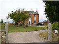

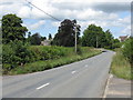
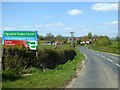
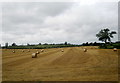
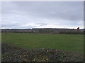
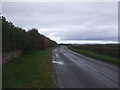

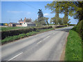
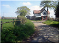

20 photos from this area
Area Information
Key information about the HR6 0AJ including its size, population, and administrative classification.
- Area Type
- Postcode
- Area Size
- 91.4 hectares
- Population
- 1277
- Population Density
- 33 people/km²
House Prices in HR6 0AJ
19
Properties
£511,817
Average Sold Price
£172,500
Lowest Price
£940,000
Highest Price
Showing 19 properties
| Address | Type | Beds | Baths | Last Sale Price | Last Sale Date | |
|---|---|---|---|---|---|---|
| The Orchards, B 4361 From Upper Court To Broad Lane, Nordan, HR6 0AJ | Bungalow | - | - | £367,500 | May 2024 | |
| Springfield, B 4361 From Upper Court To Broad Lane, Nordan, HR6 0AJ | Detached | 5 | 4 | £940,000 | Aug 2020 | |
| Vine Cottage, B 4361 From Upper Court To Broad Lane, Nordan, HR6 0AJ | Cottage | 2 | 1 | £187,500 | Aug 2019 | |
| Nordan Farm, B 4361 From Upper Court To Broad Lane, Nordan, HR6 0AJ | Detached | - | - | £723,402 | Jan 2018 | |
| Avening, B 4361 From Upper Court To Broad Lane, Nordan, HR6 0AJ | Semi-detached | - | - | £172,500 | Oct 2005 | |
| Nordan Hall, B 4361 From Upper Court To Broad Lane, Nordan, HR6 0AJ | house | 6 | - | £680,000 | Aug 2005 | |
| Nordan Cottage, B 4361 From Upper Court To Broad Lane, Nordan, HR6 0AJ | Detached | 4 | 1 | - | - | |
| The Old Stables, Nordan Hall, B 4361 From Upper Court To Broad Lane, Nordan, HR6 0AJ | undefined | - | - | - | - | |
| Mission Room, B 4361 From Broad Lane To Bridge Street, Leominster, HR6 0AJ | commercial | - | - | - | - | |
| Chalford, B 4361 From Upper Court To Broad Lane, Nordan, HR6 0AJ | Semi-detached | - | - | - | - |
Page 1 of 2
Energy Efficiency in HR6 0AJ
Amenities
Schools
| Rank | School | Type | Entry gender | Ages |
|---|
Explore more schools in this area
Go to Schools tabDemographics
Household Size
Two person
most common
Accommodation Type
Houses
most common
Tenure
76
majority
Ethnic Group
White
most common
Religion
N/A
most common
Household Composition
N/A
most common
Age
47
median
Adults (30-64 years)
most common
Household Deprivation
N/A
with no deprivation
NS-SEC
37
in Lower managerial occupations
Explore more demographic insights in this area
Go to Demographics tabPlanning
Planning Constraints
- Flood RiskPremium
- Ramsar Wetland SitesPremium
- Area of Outstanding Natural BeautyPremium
- Protected Nature ReservePremium
- Protected WoodlandPremium