Area Overview for HR6 0AF
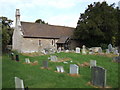
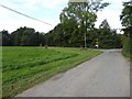
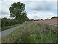
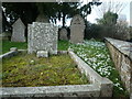
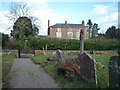
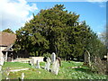
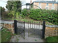
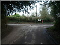
Photos of HR6 0AF


Area Information
HR6 0AF is a small, tightly knit residential postcode area in England, home to 1,277 people spread across a low-density landscape of 33 people per square kilometre. This is a quiet, established community characterised by its modest size and the prevalence of owner-occupied homes. The area’s population skews towards adults aged 30–64, suggesting a mature, stable demographic. Daily life here is likely to be low-key, with a focus on local amenities and proximity to nearby towns. The absence of major infrastructure or high-density development means HR6 0AF retains a rural or semi-rural feel, though its small size means residents may need to travel to larger centres for broader services. The low crime risk and lack of environmental constraints make it an attractive option for those seeking a peaceful, secure place to live without the pressures of urban life. For buyers, the area offers a snapshot of traditional English countryside living, with homes that are likely to be family-focused and built to last.
- Area Type
- Postcode
- Area Size
- Not available
- Population
- 1277
- Population Density
- 33 people/km²
HR6 0AF is a predominantly owner-occupied area, with 76% of homes owned by residents rather than rented. This suggests a community of long-term residents who have invested in their properties, which may influence the local property market’s dynamics. The accommodation type is primarily houses, which is typical of low-density areas and may appeal to those seeking larger living spaces or garden access. However, the small size of the area means the housing stock is limited, and buyers may need to look beyond HR6 0AF for more options. The high home ownership rate also implies that rental availability is likely to be scarce, which could be a consideration for those seeking to let properties. For buyers, the area offers a chance to purchase in a stable, low-risk environment, though the limited number of homes may mean competition is fierce, and prices could be influenced by proximity to nearby towns with more amenities.
House Prices in HR6 0AF
No properties found in this postcode.
Energy Efficiency in HR6 0AF
Residents of HR6 0AF have access to a modest range of amenities within practical reach. The area includes four retail outlets, such as Morrisons Leominster, Co-op Leominster, and Aldi Leominster, providing essential shopping options for daily needs. The Leominster Railway Station offers a direct link to nearby towns, enhancing connectivity for commuting or leisure travel. While the data does not mention parks or leisure facilities, the presence of retail and rail services suggests a functional, community-focused lifestyle. The small number of amenities reflects the area’s low population density, meaning residents may need to travel further for more specialised services. Nonetheless, the proximity to retail and transport options ensures convenience for basic needs, supporting a simple, self-sufficient way of life.
Amenities
Schools
Residents of HR6 0AF have access to two primary schools within practical reach: Luston Primary School and Kimbolton St James CofE Primary School. Both institutions hold an Ofsted rating of “good,” indicating they meet or exceed national standards for education. The presence of two primary schools suggests a focus on early education, though the absence of secondary schools in the data means families may need to travel to nearby towns for further schooling. The mix of school types—both state and church-affiliated—offers families a choice between secular and faith-based education. For parents prioritising quality primary education, the “good” ratings provide reassurance, but the lack of secondary options may be a consideration for those planning long-term in the area.
| Rank | School | Type | Entry gender | Ages |
|---|
Explore more schools in this area
Go to Schools tabDemographics
The population of HR6 0AF is predominantly adults aged 30–64, with a median age of 47. This suggests a community of middle-aged residents, many of whom may be in their peak earning years or nearing retirement. Home ownership is high, with 76% of households owning their homes, indicating a stable, long-term resident base. The accommodation type is primarily houses, which aligns with the area’s low population density and likely rural or semi-rural character. The predominant ethnic group is White, reflecting a homogenous demographic profile. There is no data on deprivation levels, but the high home ownership and low crime risk suggest a relatively affluent or middle-income community. The absence of younger families or students may mean the area lacks the vibrancy of a growing population, though it offers a quiet, settled environment for those prioritising stability and security.
Household Size
Accommodation Type
Tenure
Ethnic Group
Religion
Household Composition
Age
Household Deprivation
NS-SEC
Explore more demographic insights in this area
Go to Demographics tabPlanning
Planning Constraints
- Flood RiskPremium
- Ramsar Wetland SitesPremium
- Area of Outstanding Natural BeautyPremium
- Protected Nature ReservePremium
- Protected WoodlandPremium