Area Overview for HR5 3EA
Photos of HR5 3EA
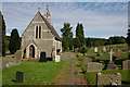
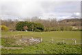
2 photos from this area
Area Information
Key information about the HR5 3EA including its size, population, and administrative classification.
- Area Type
- Postcode
- Area Size
- 30.6 hectares
- Population
- 1768
- Population Density
- 50 people/km²
House Prices in HR5 3EA
24
Properties
£219,687
Average Sold Price
£60,000
Lowest Price
£408,428
Highest Price
Showing 24 properties
| Address | Type | Beds | Baths | Last Sale Price | Last Sale Date | |
|---|---|---|---|---|---|---|
| Ryburn, 13 Eardisley Road, Kington, HR5 3EA | Detached | 4 | 2 | £408,428 | Aug 2025 | |
| 23 Eardisley Road, Kington, HR5 3EA | house | - | - | £165,000 | Dec 2022 | |
| 37 Eardisley Road, Kington, HR5 3EA | Bungalow | - | - | £340,000 | Dec 2020 | |
| Rhosmaen, 5 Eardisley Road, Kington, HR5 3EA | house | - | - | £260,000 | Oct 2018 | |
| Brookfield, 29 Eardisley Road, Kington, HR5 3EA | Detached | 5 | - | £340,000 | Nov 2017 | |
| Copperfields, 33 Eardisley Road, Kington, HR5 3EA | Detached | 3 | 2 | £360,000 | Sep 2015 | |
| 21 Eardisley Road, Kington, HR5 3EA | Semi-detached | 2 | - | £133,000 | May 2015 | |
| Highgate, 3 Eardisley Road, Kington, HR5 3EA | Detached | 4 | 2 | £352,000 | Apr 2014 | |
| Chastleton, 1 Eardisley Road, Kington, HR5 3EA | Detached | 3 | 1 | £142,500 | Mar 2009 | |
| 17 Eardisley Road, Kington, HR5 3EA | Terraced | 2 | - | £105,000 | Feb 2004 |
Page 1 of 3
Energy Efficiency in HR5 3EA
Amenities
Schools
| Rank | School | Type | Entry gender | Ages |
|---|
Explore more schools in this area
Go to Schools tabDemographics
Household Size
Two person
most common
Accommodation Type
Houses
most common
Tenure
65
majority
Ethnic Group
White
most common
Religion
N/A
most common
Household Composition
N/A
most common
Age
47
median
Adults (30-64 years)
most common
Household Deprivation
N/A
with no deprivation
NS-SEC
28
in Lower managerial occupations
Explore more demographic insights in this area
Go to Demographics tabPlanning
Planning Constraints
- Flood RiskPremium
- Ramsar Wetland SitesPremium
- Area of Outstanding Natural BeautyPremium
- Protected Nature ReservePremium
- Protected WoodlandPremium