Area Overview for HR4 9XQ
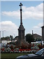
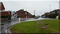
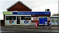
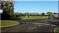
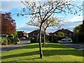
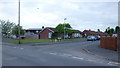
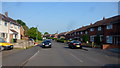
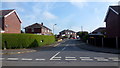
Photos of HR4 9XQ


Area Information
Living in HR4 9XQ offers a quiet, compact residential experience in a small cluster of homes typical of rural or semi-rural England. With a population of 1,638, the area feels close-knit, where daily life is shaped by proximity to local amenities and a straightforward, low-key rhythm. The postcode covers a small footprint, making it ideal for those seeking a manageable, community-focused environment. Residents here benefit from nearby retail options such as Co-op Whitecross, Tesco Hereford, and Asda Hereford, ensuring essentials are within reach. A single railway station in Hereford provides access to broader transport networks, though the area’s small size means most errands and leisure activities are handled locally. The demographic profile suggests a mature population, with adults aged 30–64 forming the majority. This balance of practicality and simplicity makes HR4 9XQ a viable choice for those prioritising stability over urban dynamism.
- Area Type
- Postcode
- Area Size
- Not available
- Population
- 1638
- Population Density
- 5664 people/km²
The property market in HR4 9XQ is characterised by a high rate of home ownership (59%) and a focus on houses rather than flats or apartments. This suggests a predominantly owner-occupied area, with properties likely to be family homes or long-term investments. The small population and compact footprint mean the housing stock is limited in scale, but the prevalence of houses indicates a preference for private, standalone living. For buyers, this implies a market where properties are likely to be in stable demand, particularly among those seeking a low-maintenance, semi-rural lifestyle. The immediate surroundings may offer similar housing types, though the area’s small size means competition for properties could be limited.
House Prices in HR4 9XQ
No properties found in this postcode.
Energy Efficiency in HR4 9XQ
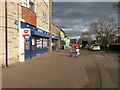
Residents of HR4 9XQ have access to a modest but functional range of amenities within practical reach. Five retail outlets, including Co-op Whitecross, Tesco Hereford, and Asda Hereford, provide everyday shopping convenience, reducing the need for long trips. The Hereford Railway Station offers a direct link to nearby towns and cities, though the area’s small size means most leisure and social activities are centred locally. While parks or green spaces are not explicitly mentioned in the data, the absence of protected natural areas suggests a focus on practical living over recreational landscapes. The combination of retail access and transport options creates a lifestyle that prioritises ease of daily living over expansive leisure opportunities.
Amenities
Schools
| Rank | School | Type | Entry gender | Ages |
|---|
Explore more schools in this area
Go to Schools tabDemographics
The community in HR4 9XQ is predominantly composed of adults aged 30–64, with a median age of 47. This suggests a mature, established population, likely with long-term ties to the area. Home ownership is strong, with 59% of residents owning their homes, indicating a stable housing market. The accommodation type is primarily houses, reflecting a preference for single-family living over flats or apartments. The predominant ethnic group is White, though no specific data on diversity or deprivation is provided. The absence of detailed diversity metrics means the area’s cultural makeup remains less defined in the data. For quality of life, the high home ownership rate and mature age profile suggest a community focused on long-term residency rather than transient populations.
Household Size
Accommodation Type
Tenure
Ethnic Group
Religion
Household Composition
Age
Household Deprivation
NS-SEC
Explore more demographic insights in this area
Go to Demographics tabPlanning
Planning Constraints
- Flood RiskPremium
- Ramsar Wetland SitesPremium
- Area of Outstanding Natural BeautyPremium
- Protected Nature ReservePremium
- Protected WoodlandPremium