Area Overview for HR4 9SH
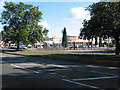
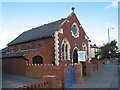
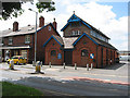
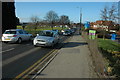
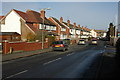
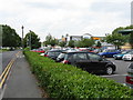
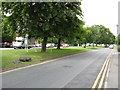
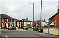
Photos of HR4 9SH


Area Information
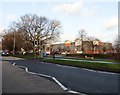
Living in HR4 9SH means being part of a tightly knit residential cluster in England, where 1,577 people reside across 1.8 hectares. The area’s compact size fosters a close-knit community, with a population density of 765 people per square kilometre. This postcode is characterised by its modest scale, offering a quiet alternative to larger towns. The area’s residents, predominantly adults aged 30–64, reflect a mature demographic, with a median age of 47. Daily life here is shaped by proximity to essential services, including retail outlets and a railway station. While the area lacks natural landscapes like AONBs or protected woodlands, its low flood risk and absence of environmental constraints make it a practical choice for those prioritising safety and simplicity. HR4 9SH is not a sprawling suburb but a defined space where homes are primarily owner-occupied, and the community’s rhythm is defined by local amenities and nearby educational institutions.
- Area Type
- Postcode
- Area Size
- 1.8 hectares
- Population
- 1577
- Population Density
- 765 people/km²
The property market in HR4 9SH is characterised by a high rate of home ownership (54%) and a predominance of houses over other accommodation types. This suggests a residential area where long-term occupancy is common, with fewer rental properties. Given the small area size of 1.8 hectares and a population of 1,577, the housing stock is likely limited, making the immediate surroundings crucial for buyers. The focus on houses rather than flats or apartments indicates a preference for traditional, family-friendly properties. For prospective buyers, this means competition for available homes may be higher, and the market is less influenced by short-term rental trends. The area’s compact nature also means that proximity to schools, transport, and amenities is a key consideration for those seeking to purchase property here.
House Prices in HR4 9SH
No properties found in this postcode.
Energy Efficiency in HR4 9SH
The lifestyle in HR4 9SH is shaped by its proximity to practical amenities. Residents can access retail outlets such as Iceland Hereford, Asda Hereford, and Spar, offering everyday shopping needs. The Hereford Railway Station provides direct rail links, facilitating travel to nearby towns and cities. While the area itself is small, its immediate surroundings include these essential services, contributing to a convenient, self-contained lifestyle. The absence of large-scale leisure or entertainment venues means that residents may need to travel further for cultural or recreational activities. However, the combination of retail, transport, and nearby schools creates a functional environment suited to families and those prioritising accessibility over extensive amenities.
Amenities
Schools
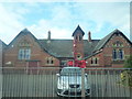
Residents of HR4 9SH have access to a range of educational institutions, including Holmer CofE Primary School, which serves younger children, and Brookfield School, a special needs institution. The Holmer CofE Academy, rated outstanding by Ofsted, offers secondary education and is a notable asset for families. Two schools named The Brookfield School also cater to special needs, though their specific roles are not detailed. This mix of primary, special, and academy schools provides options for different educational needs, though the absence of secondary schools other than the academy may require commuting for some students. The presence of an outstanding-rated school enhances the area’s appeal for families prioritising quality education.
| Rank | School | Type | Entry gender | Ages |
|---|
Explore more schools in this area
Go to Schools tabDemographics
The community in HR4 9SH is predominantly composed of adults aged 30–64, with a median age of 47. This suggests a stable population, likely with long-term residents and families. Home ownership is strong, with 54% of properties owned by their occupants, indicating a preference for settled living. The area is largely composed of houses, reflecting a traditional housing stock rather than flats or apartments. The predominant ethnic group is White, though no specific data on diversity or deprivation is provided. The population density of 765 people per square kilometre implies a moderately populated area, balancing privacy with accessibility. For buyers, this demographic profile suggests a community focused on stability, with fewer transient residents and a mature age group likely prioritising established amenities and schools.
Household Size
Accommodation Type
Tenure
Ethnic Group
Religion
Household Composition
Age
Household Deprivation
NS-SEC
Explore more demographic insights in this area
Go to Demographics tabPlanning
Planning Constraints
- Flood RiskPremium
- Ramsar Wetland SitesPremium
- Area of Outstanding Natural BeautyPremium
- Protected Nature ReservePremium
- Protected WoodlandPremium