Area Overview for HR4 9PB
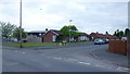
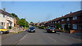
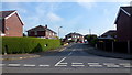
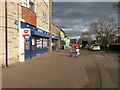
Photos of HR4 9PB
Area Information
HR4 9PB is a compact residential postcode area in England, covering just 4.1 hectares and home to 1577 residents. Its small size means it feels like a tight-knit community, with a population density of 765 people per square kilometre. The area is characterised by its mix of older and newer housing, with a median age of 47, suggesting a population skewed towards adults aged 30–64. Daily life here is likely to revolve around local amenities and the nearby railway station in Hereford. The area’s proximity to retail outlets and schools makes it practical for families, while its low flood risk and absence of protected natural sites indicate a relatively straightforward planning environment. For those seeking a quiet, manageable space with access to essentials, HR4 9PB offers a balance of convenience and simplicity. Its modest size means it is not a sprawling suburb, but rather a focused cluster of homes, ideal for those who value proximity to services without the hustle of larger urban centres.
- Area Type
- Postcode
- Area Size
- 4.1 hectares
- Population
- 1577
- Population Density
- 765 people/km²
The property market in HR4 9PB is shaped by its small size and focus on owner-occupation. With 54% of homes owned by residents, the area leans towards a mix of private ownership and rental properties, though the exact proportion of rentals is not specified. The accommodation type is predominantly houses, which suggests a preference for single-family homes over apartments or flats. This could make the area appealing to families or those seeking more space, but it also means the housing stock is limited, particularly for buyers looking to expand beyond the immediate postcode. The compact nature of HR4 9PB means that property availability is likely to be constrained, and prices may reflect the area’s desirability for its amenities and connectivity. For buyers, the challenge lies in the small footprint of the area, requiring consideration of nearby neighbourhoods for broader options.
House Prices in HR4 9PB
Showing 2 properties
| Address | Type | Beds | Baths | Last Sale Price | Last Sale Date | |
|---|---|---|---|---|---|---|
| Avara Foods, Avara Foods Grandstand Block, Grandstand Road, Hereford, HR4 9PB | Industrial | - | - | - | - | |
| Avara Foods, Ochard Block, Grandstand Road, Hereford, HR4 9PB | Industrial | - | - | - | - |
Energy Efficiency in HR4 9PB
Daily life in HR4 9PB benefits from nearby amenities that cater to practical needs. The area has five retail outlets within reach, including Co-op Whitecross, Tesco Hereford, and Asda Hereford, ensuring easy access to groceries and everyday essentials. The Hereford Railway Station provides a direct link to broader transport networks, facilitating travel to work, shopping, or leisure. While the data does not mention parks or leisure facilities, the absence of protected natural sites or AONB coverage suggests that recreational spaces may be limited to local green areas or community facilities. The retail options and railway access contribute to a convenient lifestyle, though residents may need to venture further for more extensive leisure opportunities.
Amenities
Schools
Residents of HR4 9PB have access to a range of educational institutions, including primary and special schools. Holmer CofE Primary School serves younger children, while Brookfield School and The Brookfield School cater to students with special educational needs. The standout option is Holmer CofE Academy, which holds an Ofsted rating of outstanding. This mix of school types ensures that families have choices, whether they require mainstream education or specialist support. The presence of an outstanding academy suggests high-quality teaching and facilities, which could be a significant draw for parents prioritising academic standards. However, the concentration of special schools may indicate a local need for such services, which could influence the community’s character. For those seeking a comprehensive education system, the variety of schools in proximity to HR4 9PB offers flexibility.
| Rank | School | Type | Entry gender | Ages |
|---|
Explore more schools in this area
Go to Schools tabDemographics
The population of HR4 9PB is predominantly adults aged 30–64, with a median age of 47. This suggests a community of established professionals, families, and older residents, rather than a student or young professional demographic. Home ownership stands at 54%, indicating a mix of owner-occupied and rental properties. The area is largely composed of houses, not flats, which may appeal to those seeking more space or a traditional family home. The predominant ethnic group is White, though the data does not specify further diversity metrics. With a population density of 765 people per square kilometre, the area is neither sparse nor overcrowded, allowing for a moderate level of privacy. The relatively high proportion of adult residents may contribute to a stable, low-turnover community. However, the lack of specific data on deprivation or income levels means the quality of life for residents cannot be fully assessed beyond the provided figures.
Household Size
Accommodation Type
Tenure
Ethnic Group
Religion
Household Composition
Age
Household Deprivation
NS-SEC
Explore more demographic insights in this area
Go to Demographics tabPlanning
Planning Constraints
- Flood RiskPremium
- Ramsar Wetland SitesPremium
- Area of Outstanding Natural BeautyPremium
- Protected Nature ReservePremium
- Protected WoodlandPremium