Area Overview for HR4 8JG
Photos of HR4 8JG
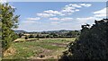
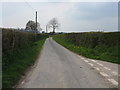
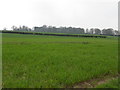
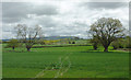
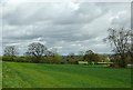
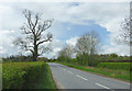
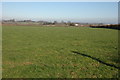
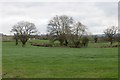
21 photos from this area
Area Information
Key information about the HR4 8JG including its size, population, and administrative classification.
- Area Type
- Postcode
- Area Size
- 1.0 km²
- Population
- 1472
- Population Density
- 37 people/km²
House Prices in HR4 8JG
14
Properties
£385,000
Average Sold Price
£350,000
Lowest Price
£420,000
Highest Price
Showing 14 properties
| Address | Type | Beds | Baths | Last Sale Price | Last Sale Date | |
|---|---|---|---|---|---|---|
| Stockingfield Cottage, A 4112 From A 44 To Hurst Lane, Dilwyn, HR4 8JG | house | - | - | £420,000 | Mar 2021 | |
| Hollybank, A 4112 From A 44 To Hurst Lane, Dilwyn, HR4 8JG | house | - | - | £350,000 | Jun 2020 | |
| Plateau, C 1084 From A 4112 To Luntley, Dilwyn, HR4 8JG | Detached | 4 | 3 | - | - | |
| Small Feet Farming Holiday Lodges, Holiday Lodges, Small Feet Farming At Greenfields, A 4112 From A 44 To Hurst Lane, Dilwyn, HR4 8JG | Farm | - | - | - | - | |
| Three Acres, A 4112 From A 44 To Hurst Lane, Dilwyn, HR4 8JG | Detached | 4 | - | - | - | |
| Caravan, The Croft, A 4112 From A 44 To Hurst Lane, Dilwyn, HR4 8JG | Mobile Home | - | - | - | - | |
| Bramlea, A 4112 From A 44 To Hurst Lane, Dilwyn, HR4 8JG | Detached | - | - | - | - | |
| Yew Tree Cottage, A 4112 From A 44 To Hurst Lane, Dilwyn, HR4 8JG | house | - | - | - | - | |
| Greycote, A 4112 From A 44 To Hurst Lane, Dilwyn, HR4 8JG | house | - | - | - | - | |
| The Croft, A 4112 From A 44 To Hurst Lane, Dilwyn, HR4 8JG | Detached | - | - | - | - |
Page 1 of 2
Energy Efficiency in HR4 8JG
Amenities
Schools
| Rank | School | Type | Entry gender | Ages |
|---|
Explore more schools in this area
Go to Schools tabDemographics
Household Size
Two person
most common
Accommodation Type
Houses
most common
Tenure
78
majority
Ethnic Group
White
most common
Religion
N/A
most common
Household Composition
N/A
most common
Age
47
median
Adults (30-64 years)
most common
Household Deprivation
N/A
with no deprivation
NS-SEC
36
in Lower managerial occupations
Explore more demographic insights in this area
Go to Demographics tabPlanning
Planning Constraints
- Flood RiskPremium
- Ramsar Wetland SitesPremium
- Area of Outstanding Natural BeautyPremium
- Protected Nature ReservePremium
- Protected WoodlandPremium