Area Overview for HR4 8AP
Photos of HR4 8AP
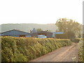
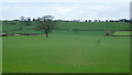
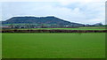
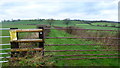
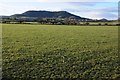
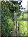
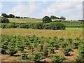
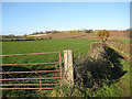
26 photos from this area
Area Information
Key information about the HR4 8AP including its size, population, and administrative classification.
- Area Type
- Postcode
- Area Size
- 70.0 hectares
- Population
- 1775
- Population Density
- 60 people/km²
House Prices in HR4 8AP
26
Properties
£347,500
Average Sold Price
£142,500
Lowest Price
£695,000
Highest Price
Showing 26 properties
| Address | Type | Beds | Baths | Last Sale Price | Last Sale Date | |
|---|---|---|---|---|---|---|
| Norton House, C 1109 The Row, Wellington, HR4 8AP | Detached | - | - | £695,000 | Jun 2021 | |
| Knapp Cottage, C 1109 The Row, Wellington, HR4 8AP | Detached | 4 | 1 | £375,000 | Feb 2021 | |
| Penarth, C 1109 The Row, Wellington, HR4 8AP | Bungalow | - | - | £270,000 | Aug 2018 | |
| Barberry House, C 1109 The Row, Wellington, HR4 8AP | Detached | 3 | 2 | £515,000 | Jul 2018 | |
| Adzor Mews, C 1109 The Row, Wellington, HR4 8AP | Detached | 3 | 2 | £280,000 | Sep 2017 | |
| Touchwood, C 1109 The Row, Wellington, HR4 8AP | Bungalow | 3 | - | £365,000 | Mar 2015 | |
| Hill Lodge, C 1109 The Row, Wellington, HR4 8AP | house | 4 | - | £335,000 | Sep 2012 | |
| Poppys, C 1109 The Row, Wellington, HR4 8AP | Detached | - | - | £265,000 | Sep 2007 | |
| Festive Farm, C 1108 From Upper Derndale To C 1109, Wellington, HR4 8AP | Detached | - | - | £430,000 | Jan 2005 | |
| Maple Cottage, C 1109 The Row, Wellington, HR4 8AP | Detached | - | - | £150,000 | Sep 2003 |
Page 1 of 3
Energy Efficiency in HR4 8AP
Amenities
Schools
| Rank | School | Type | Entry gender | Ages |
|---|
Explore more schools in this area
Go to Schools tabDemographics
Household Size
Two person
most common
Accommodation Type
Houses
most common
Tenure
76
majority
Ethnic Group
White
most common
Religion
N/A
most common
Household Composition
N/A
most common
Age
47
median
Adults (30-64 years)
most common
Household Deprivation
N/A
with no deprivation
NS-SEC
41
in Lower managerial occupations
Explore more demographic insights in this area
Go to Demographics tabPlanning
Planning Constraints
- Flood RiskPremium
- Ramsar Wetland SitesPremium
- Area of Outstanding Natural BeautyPremium
- Protected Nature ReservePremium
- Protected WoodlandPremium