Area Overview for HR4 7AR
Photos of HR4 7AR
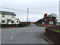


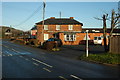

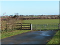
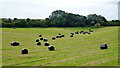
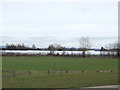

11 photos from this area
Area Information
Key information about the HR4 7AR including its size, population, and administrative classification.
- Area Type
- Postcode
- Area Size
- 59.0 hectares
- Population
- 1675
- Population Density
- 114 people/km²
House Prices in HR4 7AR
28
Properties
£324,389
Average Sold Price
£60,000
Lowest Price
£550,000
Highest Price
Showing 28 properties
| Address | Type | Beds | Baths | Last Sale Price | Last Sale Date | |
|---|---|---|---|---|---|---|
| Haytor, The Priory, Stretton Sugwas, HR4 7AR | house | 3 | 1 | £485,000 | Sep 2024 | |
| Nyali, The Priory, Stretton Sugwas, HR4 7AR | Detached | 3 | 2 | £550,000 | Jul 2022 | |
| 29, Stretton Cross, A 480 From Clifford House To Stretton Court Farm, Stretton Sugwas, HR4 7AR | house | 4 | 3 | £275,000 | May 2022 | |
| Penmar, The Priory, Stretton Sugwas, HR4 7AR | Detached | - | - | £410,000 | Sep 2009 | |
| Tythings, The Priory, Stretton Sugwas, HR4 7AR | Detached | - | - | £530,000 | May 2008 | |
| Wolferton House, The Priory, Stretton Sugwas, HR4 7AR | Detached | - | - | £305,000 | Aug 2007 | |
| Yazor Brook, The Priory, Stretton Sugwas, HR4 7AR | Semi-detached | - | - | £175,000 | Aug 2004 | |
| Yazor Lea, The Priory, Stretton Sugwas, HR4 7AR | Semi-detached | - | - | £129,500 | Jan 2004 | |
| Little Owls, The Priory, Stretton Sugwas, HR4 7AR | Detached | - | - | £60,000 | Jul 1998 | |
| 30, Stretton Cross, A 480 From Clifford House To Stretton Court Farm, Stretton Sugwas, HR4 7AR | Semi-detached | 3 | 1 | - | - |
Page 1 of 3
Energy Efficiency in HR4 7AR
Amenities
Schools
| Rank | School | Type | Entry gender | Ages |
|---|
Explore more schools in this area
Go to Schools tabDemographics
Household Size
Two person
most common
Accommodation Type
Houses
most common
Tenure
81
majority
Ethnic Group
White
most common
Religion
N/A
most common
Household Composition
N/A
most common
Age
47
median
Adults (30-64 years)
most common
Household Deprivation
N/A
with no deprivation
NS-SEC
34
in Lower managerial occupations
Explore more demographic insights in this area
Go to Demographics tabPlanning
Planning Constraints
- Flood RiskPremium
- Ramsar Wetland SitesPremium
- Area of Outstanding Natural BeautyPremium
- Protected Nature ReservePremium