Area Overview for HR4 0RG
Photos of HR4 0RG
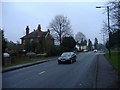
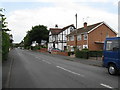
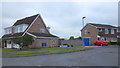
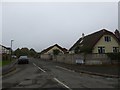
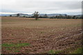
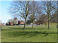
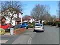
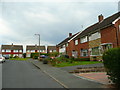
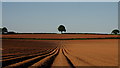
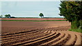
12 photos from this area
Area Information
Key information about the HR4 0RG including its size, population, and administrative classification.
- Area Type
- Postcode
- Area Size
- 2.1 hectares
- Population
- 1566
- Population Density
- 715 people/km²
House Prices in HR4 0RG
39
Properties
£321,005
Average Sold Price
£140,500
Lowest Price
£585,000
Highest Price
Showing 39 properties
| Address | Type | Beds | Baths | Last Sale Price | Last Sale Date | |
|---|---|---|---|---|---|---|
| 46 Kings Acre Road, Hereford, HR4 0RG | Detached | 3 | 2 | £345,000 | Jun 2025 | |
| 86 Kings Acre Road, Hereford, HR4 0RG | Bungalow | 2 | 1 | £280,000 | Sep 2024 | |
| 108 Kings Acre Road, Hereford, HR4 0RG | Detached | 4 | 2 | £350,000 | Aug 2024 | |
| 44 Kings Acre Road, Hereford, HR4 0RG | Detached | 2 | 1 | £252,000 | Jul 2023 | |
| 48 Kings Acre Road, Hereford, HR4 0RG | Semi-detached | 3 | 1 | £287,500 | Mar 2023 | |
| 28 Kings Acre Road, Hereford, HR4 0RG | Semi-detached | 4 | 1 | £280,000 | Oct 2021 | |
| 30 Kings Acre Road, Hereford, HR4 0RG | house | - | - | £325,000 | Aug 2021 | |
| 12 Kings Acre Road, Hereford, HR4 0RG | Detached | 6 | 3 | £585,000 | Jun 2021 | |
| 96 Kings Acre Road, Hereford, HR4 0RG | house | 4 | 3 | £420,000 | Jan 2021 | |
| 98 Kings Acre Road, Hereford, HR4 0RG | house | - | - | £400,000 | Feb 2020 |
Page 1 of 4
Energy Efficiency in HR4 0RG
Amenities
Schools
| Rank | School | Type | Entry gender | Ages |
|---|
Explore more schools in this area
Go to Schools tabDemographics
Household Size
Two person
most common
Accommodation Type
Houses
most common
Tenure
85
majority
Ethnic Group
White
most common
Religion
N/A
most common
Household Composition
N/A
most common
Age
47
median
Adults (30-64 years)
most common
Household Deprivation
N/A
with no deprivation
NS-SEC
35
in Lower managerial occupations
Explore more demographic insights in this area
Go to Demographics tabPlanning
Planning Constraints
- Flood RiskPremium
- Ramsar Wetland SitesPremium
- Area of Outstanding Natural BeautyPremium
- Protected Nature ReservePremium
- Protected WoodlandPremium