Area Overview for HR4 0JS
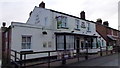
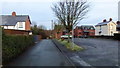
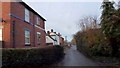
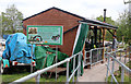
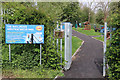
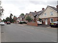
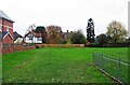
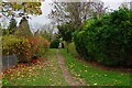
Photos of HR4 0JS
Area Information
Living in HR4 0JS means inhabiting a compact, densely populated residential cluster in England. The area spans just 2.1 hectares, yet it is home to 1,769 people, translating to a population density of 85,149 people per square kilometre. This density suggests a tightly knit community where proximity to neighbours is inevitable. The area’s small size means daily life is centred around a limited number of local amenities, though its proximity to Hereford’s infrastructure ensures access to broader services. HR4 0JS is not a sprawling suburb but a focused, residential enclave, likely characterised by older housing stock given the high home ownership rate and the predominance of houses. For those seeking a quiet, established neighbourhood with minimal sprawl, this postcode offers a self-contained environment. However, its compact nature also means residents must consider the practicality of local amenities and transport links when evaluating long-term suitability.
- Area Type
- Postcode
- Area Size
- 2.1 hectares
- Population
- 1769
- Population Density
- 1856 people/km²
The property market in HR4 0JS is characterised by a high rate of home ownership (74%) and a predominance of houses. This suggests a market skewed towards owner-occupied properties rather than rental units, likely reflecting the area’s established nature and the appeal of detached or semi-detached homes. Given the small size of the postcode (2.1 hectares), the housing stock is likely limited in volume, which could mean competition for available properties. The focus on houses may also indicate a preference for private, low-density living, which could be a draw for families or individuals seeking space. However, buyers should consider the area’s compactness when assessing proximity to amenities or transport links. The market’s stability, driven by long-term residents, may offer predictability but could also mean fewer new developments or modern properties.
House Prices in HR4 0JS
Showing 1 properties
| Address | Type | Beds | Baths | Last Sale Price | Last Sale Date | |
|---|---|---|---|---|---|---|
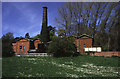
| Welsh Water, Water Treatment Works, Broomy Hill, Hereford, HR4 0JS | miscellaneous_24hr | - | - | - | - |
Energy Efficiency in HR4 0JS
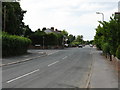
Daily life in HR4 0JS is shaped by its proximity to key retail venues, including Tesco Hereford, Sainsburys Hereford, and Co-op Whitecross. These stores provide essential shopping options, reducing the need for long commutes. The presence of Hereford Railway Station adds convenience for travel beyond the immediate area. While the data does not mention parks or leisure facilities, the compact nature of the postcode suggests a focus on local amenities rather than expansive recreational spaces. The character of the area is defined by its residential tranquillity, with shopping and transport needs met through nearby hubs. This balance of convenience and seclusion may appeal to those seeking a self-contained lifestyle with access to essential services.
Amenities
Schools
The nearest school to HR4 0JS is Haberdashers Redcap School, an independent institution. This type of school typically offers fee-paying education with a focus on academic and extracurricular excellence. While the data does not include Ofsted ratings or specific academic performance metrics, the presence of an independent school suggests the area may attract families seeking private education. However, the absence of state schools in the immediate vicinity means families relying on public education would need to look beyond HR4 0JS. The limited school options highlight the importance of proximity to broader educational networks, particularly for those prioritising state schooling. For parents valuing independent education, this school could be a key factor in the area’s appeal.
| Rank | School | Type | Entry gender | Ages |
|---|
Explore more schools in this area
Go to Schools tabDemographics
The community in HR4 0JS is predominantly composed of adults aged 30–64, with a median age of 47. This suggests a mature, stable population with established careers and family structures. Home ownership is high at 74%, indicating a strong presence of long-term residents rather than transient renters. The accommodation type is primarily houses, which aligns with the area’s likely suburban or semi-rural character. The predominant ethnic group is White, though the data does not specify further diversity metrics. The age profile implies a community with a focus on family life, though the absence of data on younger demographics or children’s proportions means the full picture of generational balance remains unclear. The high home ownership rate and older median age suggest a low turnover of properties, which can stabilise local markets but may limit options for first-time buyers.
Household Size
Accommodation Type
Tenure
Ethnic Group
Religion
Household Composition
Age
Household Deprivation
NS-SEC
Explore more demographic insights in this area
Go to Demographics tabPlanning
Planning Constraints
- Flood RiskPremium
- Ramsar Wetland SitesPremium
- Area of Outstanding Natural BeautyPremium
- Protected Nature ReservePremium
- Protected WoodlandPremium