Area Overview for HR4 0AG
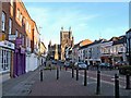
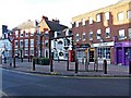
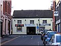
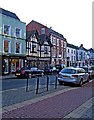
Photos of HR4 0AG


Area Information
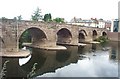
Living in HR4 0AG means inhabiting a tightly knit residential cluster in England, where 1,769 people are spread across just 1.3 hectares. This density creates a compact, community-oriented environment, with homes predominantly in private ownership. The area’s character is shaped by its proximity to Hereford’s amenities, including retail hubs like Sainsburys Hereford and the Hereford Railway Station. Daily life here is defined by accessibility—shops, transport, and schools are all within practical reach. The population, skewed toward adults aged 30–64, suggests a mature demographic, likely with established careers and families. While the area is small, its strategic location near major services makes it appealing for those seeking convenience without sacrificing residential comfort. However, the high population density also means limited space for expansion, which could influence property availability and pricing. For buyers, HR4 0AG offers a blend of practicality and proximity, though its size means every decision about living here is intimate and tightly woven into the local fabric.
- Area Type
- Postcode
- Area Size
- 1.3 hectares
- Population
- 1769
- Population Density
- 1856 people/km²
The property market in HR4 0AG is dominated by owner-occupied homes, with 74% of properties in private hands. This suggests a community of long-term residents rather than a transient rental market. The accommodation type is primarily houses, which, given the area’s small size, implies limited availability and potentially higher demand. For buyers, this means competition for a finite number of homes, with properties likely to be well-maintained and in sought-after locations. The high home ownership rate also indicates a stable market, where properties may hold value due to the area’s proximity to amenities like Hereford’s retail and transport links. However, the compact nature of HR4 0AG means that expansion is unlikely, making each property a unique opportunity within a tightly defined geographic boundary.
House Prices in HR4 0AG
Showing 1 properties
| Address | Type | Beds | Baths | Last Sale Price | Last Sale Date | |
|---|---|---|---|---|---|---|
| Sainsbury's, Petrol Filling Station, Sainsbury Supermarket, 1 Barton Yard, Hereford, HR4 0AG | retail_financial | - | - | - | - |
Energy Efficiency in HR4 0AG
Residents of HR4 0AG have access to a range of nearby amenities, including five retail outlets such as Sainsburys Hereford, Aldi Hereford, and Tesco Hereford. These shops provide everyday convenience, from grocery shopping to household essentials. The Hereford Railway Station adds to the area’s accessibility, enabling easy travel to other parts of the region. While the data does not mention parks or leisure facilities, the proximity to retail and transport hubs suggests a lifestyle focused on practicality and connectivity. The compact nature of the area means amenities are within walking or short driving distance, contributing to a sense of convenience. However, the absence of detailed information on leisure options means the full scope of lifestyle offerings remains partially unexplored.
Amenities
Schools
The nearest school to HR4 0AG is Haberdashers Redcap School, an independent institution. This means families in the area have access to private education options, though no state schools are listed in the data. The presence of an independent school suggests a community that may prioritise private schooling, potentially influencing property demand. However, the lack of state school options could be a consideration for families seeking public education. The single school listed indicates a limited range of educational choices, which may require families to travel beyond the immediate area for alternative schooling.
| Rank | School | Type | Entry gender | Ages |
|---|
Explore more schools in this area
Go to Schools tabDemographics
The community in HR4 0AG is predominantly composed of adults aged 30–64, with a median age of 47. This suggests a mature population, likely with long-term ties to the area. Home ownership is high, at 74%, indicating a stable, settled demographic. The accommodation type is largely houses, which aligns with the area’s compact residential nature. The predominant ethnic group is White, though the data does not provide further breakdowns of diversity. With 140,787 people per square kilometre, the population density is exceptionally high, which may influence social dynamics and the availability of shared spaces. This density, combined with the age profile, points to a community that values stability and proximity to services. However, the lack of detailed diversity data means broader demographic trends remain unexplored.
Household Size
Accommodation Type
Tenure
Ethnic Group
Religion
Household Composition
Age
Household Deprivation
NS-SEC
Explore more demographic insights in this area
Go to Demographics tabPlanning
Planning Constraints
- Flood RiskPremium
- Ramsar Wetland SitesPremium
- Area of Outstanding Natural BeautyPremium
- Protected Nature ReservePremium
- Protected WoodlandPremium