Area Overview for HR3 5SU
Photos of HR3 5SU
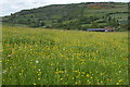
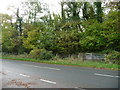
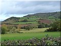
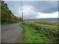
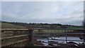
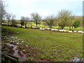
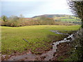
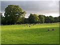
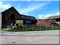
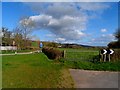
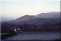
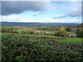
13 photos from this area
Area Information
Key information about the HR3 5SU including its size, population, and administrative classification.
- Area Type
- Postcode
- Area Size
- 90.9 hectares
- Population
- 1522
- Population Density
- 23 people/km²
House Prices in HR3 5SU
17
Properties
£501,250
Average Sold Price
£405,000
Lowest Price
£597,500
Highest Price
Showing 17 properties
| Address | Type | Beds | Baths | Last Sale Price | Last Sale Date | |
|---|---|---|---|---|---|---|
| The Gables, Browns Lane, Dorstone, HR3 5SU | Detached | 3 | 2 | £405,000 | Oct 2015 | |
| Bage Pool Barn, Scotland Bank, Dorstone, HR3 5SU | Semi-detached | 5 | 4 | £597,500 | Sep 2014 | |
| Highfield The Bage, B 4348 From Newton Middlewood To Cross Lodge, Dorstone, HR3 5SU | Detached | 5 | 2 | - | - | |
| Haie Barn The Bage, B 4348 From Newton Middlewood To Cross Lodge, Dorstone, HR3 5SU | house | 4 | 3 | - | - | |
| Bage Court, Scotland Bank, Dorstone, HR3 5SU | Detached | 5 | - | - | - | |
| Gromarlie Mobile Home, Scotland Bank, Dorstone, HR3 5SU | Mobile Home | - | - | - | - | |
| Bage Pool, Scotland Bank, Dorstone, HR3 5SU | house | - | - | - | - | |
| Bage Tump, B 4348 From Newton Middlewood To Cross Lodge, Dorstone, HR3 5SU | Detached | - | - | - | - | |
| Cwm Pryll, B 4348 From Newton Middlewood To Cross Lodge, Dorstone, HR3 5SU | Bungalow | 4 | 2 | - | - | |
| Little Bage, B 4348 From Newton Middlewood To Cross Lodge, Dorstone, HR3 5SU | Detached | - | - | - | - |
Page 1 of 2
Energy Efficiency in HR3 5SU
Amenities
Schools
| Rank | School | Type | Entry gender | Ages |
|---|
Explore more schools in this area
Go to Schools tabDemographics
Household Size
Two person
most common
Accommodation Type
Houses
most common
Tenure
78
majority
Ethnic Group
White
most common
Religion
N/A
most common
Household Composition
N/A
most common
Age
47
median
Adults (30-64 years)
most common
Household Deprivation
N/A
with no deprivation
NS-SEC
41
in Lower managerial occupations
Explore more demographic insights in this area
Go to Demographics tabPlanning
Planning Constraints
- Flood RiskPremium
- Ramsar Wetland SitesPremium
- Area of Outstanding Natural BeautyPremium
- Protected Nature ReservePremium
- Protected WoodlandPremium