Area Overview for HR2 9YP
Photos of HR2 9YP


Area Information
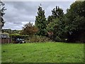
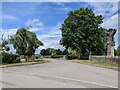
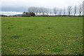
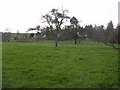
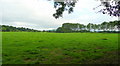
Living in HR2 9YP offers a quiet, residential lifestyle in a small cluster of homes spread across a low-density area. With a population of 1,631 and a density of 58 people per square kilometre, the area feels unspoiled and community-focused. The demographic profile suggests a mature, stable population, with a median age of 47 and a majority of residents aged 30–64. This is a place where homeownership is common—73% of homes are owner-occupied—reflecting a long-term, settled community. Daily life here is likely characterised by proximity to local amenities and a slower pace, with no significant environmental or planning constraints. The area’s small size means it is likely to feel cohesive, with residents knowing their neighbours. While it lacks the vibrancy of a larger town, HR2 9YP provides a straightforward, functional living environment, ideal for those prioritising security, stability, and a low-risk lifestyle.
- Area Type
- Postcode
- Area Size
- Not available
- Population
- 1631
- Population Density
- 58 people/km²
The property market in HR2 9YP is dominated by owner-occupied homes, with 73% of properties owned by residents rather than rented. This reflects a community of long-term residents rather than a transient rental market. The accommodation type is primarily houses, which is typical of low-density areas and suggests a more traditional, suburban feel. The small size of the area means the housing stock is limited, and buyers should consider nearby zones for additional options. The high home ownership rate indicates strong demand from locals, potentially limiting availability for newcomers. For buyers, this area may appeal to those seeking stability and a settled environment, though the narrow range of property types could restrict choices.
House Prices in HR2 9YP
No properties found in this postcode.
Energy Efficiency in HR2 9YP
Residents of HR2 9YP have access to five retail venues within practical reach, including Co-op Whitecross, Co-op Hereford, and Tesco Hereford. These provide essential shopping and grocery needs, reducing the need for long trips. The Hereford Railway Station adds convenience for commuting or travel. While the data does not mention parks or leisure facilities, the absence of planning constraints suggests open spaces may be available nearby. The retail options and rail link contribute to a functional lifestyle, supporting daily routines without requiring extensive travel.
Amenities
Schools
The nearest school to HR2 9YP is Madley Primary School, which is rated ‘good’ by Ofsted. As a primary school, it serves the needs of younger families in the area, though no secondary schools are listed in the data. The presence of a well-rated primary school is a key consideration for families, offering a foundation for early education. However, parents may need to look further afield for secondary schooling, which could affect commuting times. The school’s rating suggests a focus on quality education, which is a positive factor for homebuyers prioritising family-friendly amenities.
| Rank | School | Type | Entry gender | Ages |
|---|
Explore more schools in this area
Go to Schools tabDemographics
The community in HR2 9YP is predominantly composed of adults aged 30–64, with a median age of 47. This suggests a mature population, likely with established careers and families. Homeownership is high at 73%, indicating a strong presence of long-term residents. The accommodation type is primarily houses, which aligns with the area’s low density and residential character. The predominant ethnic group is White, with no specific data on other demographics provided. The population density of 58 people per square kilometre implies a spread-out, less congested environment, which may contribute to a quieter, more private lifestyle. While no deprivation data is available, the high home ownership and low crime risk suggest a stable, middle-income community with access to essential services.
Household Size
Accommodation Type
Tenure
Ethnic Group
Religion
Household Composition
Age
Household Deprivation
NS-SEC
Explore more demographic insights in this area
Go to Demographics tabPlanning
Planning Constraints
- Flood RiskPremium
- Ramsar Wetland SitesPremium
- Area of Outstanding Natural BeautyPremium
- Protected Nature ReservePremium
- Protected WoodlandPremium