Area Overview for HR2 9RN
Photos of HR2 9RN
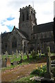
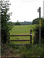
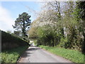
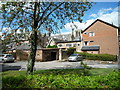
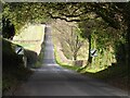
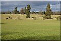

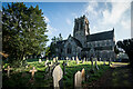
66 photos from this area
Area Information
Key information about the HR2 9RN including its size, population, and administrative classification.
- Area Type
- Postcode
- Area Size
- 2.2 hectares
- Population
- 1517
- Population Density
- 217 people/km²
House Prices in HR2 9RN
28
Properties
£296,115
Average Sold Price
£236,000
Lowest Price
£345,000
Highest Price
Showing 28 properties
| Address | Type | Beds | Baths | Last Sale Price | Last Sale Date | |
|---|---|---|---|---|---|---|
| 25 Woodfield Gardens, Belmont, HR2 9RN | Terraced | 3 | - | £345,000 | Jul 2024 | |
| 3 Woodfield Gardens, Belmont, HR2 9RN | Terraced | 4 | 2 | £315,000 | Apr 2023 | |
| 27 Woodfield Gardens, Belmont, HR2 9RN | Detached | 4 | 2 | £328,500 | Feb 2023 | |
| 8 Woodfield Gardens, Belmont, HR2 9RN | Flat | - | - | £305,000 | Apr 2022 | |
| 20 Woodfield Gardens, Belmont, HR2 9RN | Detached | 4 | - | £318,000 | Jan 2020 | |
| 17 Woodfield Gardens, Belmont, HR2 9RN | Flat | 3 | 2 | £279,995 | Jun 2019 | |
| 21 Woodfield Gardens, Belmont, HR2 9RN | house | - | - | £290,000 | Jun 2019 | |
| 26 Woodfield Gardens, Belmont, HR2 9RN | Detached | 4 | - | £310,000 | Dec 2017 | |
| 23 Woodfield Gardens, Belmont, HR2 9RN | house | - | - | £259,500 | Aug 2016 | |
| 4 Woodfield Gardens, Belmont, HR2 9RN | house | - | - | £272,500 | Aug 2015 |
Page 1 of 3
Energy Efficiency in HR2 9RN
Amenities
Schools
| Rank | School | Type | Entry gender | Ages |
|---|
Explore more schools in this area
Go to Schools tabDemographics
Household Size
Two person
most common
Accommodation Type
Houses
most common
Tenure
76
majority
Ethnic Group
White
most common
Religion
N/A
most common
Household Composition
N/A
most common
Age
47
median
Adults (30-64 years)
most common
Household Deprivation
N/A
with no deprivation
NS-SEC
31
in Lower managerial occupations
Explore more demographic insights in this area
Go to Demographics tabPlanning
Planning Constraints
- Flood RiskPremium
- Ramsar Wetland SitesPremium
- Area of Outstanding Natural BeautyPremium
- Protected Nature ReservePremium
- Protected WoodlandPremium