Area Overview for HR2 9DA
Photos of HR2 9DA

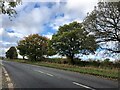
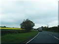
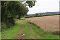
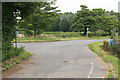
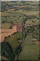
6 photos from this area
Area Information
Key information about the HR2 9DA including its size, population, and administrative classification.
- Area Type
- Postcode
- Area Size
- 2.9 km²
- Population
- 1827
- Population Density
- 33 people/km²
House Prices in HR2 9DA
29
Properties
£382,556
Average Sold Price
£90,000
Lowest Price
£890,000
Highest Price
Showing 29 properties
| Address | Type | Beds | Baths | Last Sale Price | Last Sale Date | |
|---|---|---|---|---|---|---|
| Windsmere, Didley Access, Didley, HR2 9DA | Detached | 3 | 2 | £500,000 | May 2024 | |
| Stocks Barn, A 465 From B 4348 To Lay By, Didley, HR2 9DA | Detached | 4 | 4 | £750,000 | Mar 2022 | |
| White House, Didley Access, Didley, HR2 9DA | Detached | - | - | £890,000 | Dec 2021 | |
| Former Horsecroft, A 465 From B 4348 To Lay By, Didley, HR2 9DA | Detached | - | - | £306,000 | Jul 2019 | |
| Yewtree Cottage, Whitewood Access, Didley, HR2 9DA | house | - | - | £300,000 | Oct 2016 | |
| Rose Cottage, Whitewood Access, Didley, HR2 9DA | house | - | - | £225,000 | Nov 2006 | |
| Hill Cottage, Whitewood Access, Didley, HR2 9DA | house | - | - | £284,000 | Dec 2005 | |
| Chapel Gate, A 465 From B 4348 To Lay By, Didley, HR2 9DA | Detached | - | - | £90,000 | Aug 2001 | |
| Thorneyglatt Cottage, Whitewood Access, Didley, HR2 9DA | house | - | - | £98,000 | Aug 2001 | |
| Stocks Cottage, A 465 From B 4348 To Lay By, Didley, HR2 9DA | Detached | - | - | - | - |
Page 1 of 3
Energy Efficiency in HR2 9DA
Amenities
Schools
| Rank | School | Type | Entry gender | Ages |
|---|
Explore more schools in this area
Go to Schools tabDemographics
Household Size
Two person
most common
Accommodation Type
Houses
most common
Tenure
75
majority
Ethnic Group
White
most common
Religion
N/A
most common
Household Composition
N/A
most common
Age
47
median
Adults (30-64 years)
most common
Household Deprivation
N/A
with no deprivation
NS-SEC
33
in Lower managerial occupations
Explore more demographic insights in this area
Go to Demographics tabPlanning
Planning Constraints
- Flood RiskPremium
- Ramsar Wetland SitesPremium
- Area of Outstanding Natural BeautyPremium
- Protected Nature ReservePremium
- Protected WoodlandPremium