Area Overview for HR2 8LX
Photos of HR2 8LX
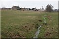
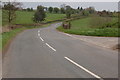
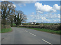
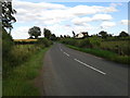
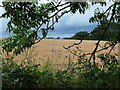
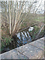
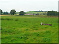

12 photos from this area
Area Information
Key information about the HR2 8LX including its size, population, and administrative classification.
- Area Type
- Postcode
- Area Size
- 38.1 hectares
- Population
- 1805
- Population Density
- 39 people/km²
House Prices in HR2 8LX
16
Properties
£300,700
Average Sold Price
£210,000
Lowest Price
£490,000
Highest Price
Showing 16 properties
| Address | Type | Beds | Baths | Last Sale Price | Last Sale Date | |
|---|---|---|---|---|---|---|
| Lower Llangunnock, B 4521 From Yew Tree Farm To Penrose Road, Three Ashes, HR2 8LX | Detached | - | - | £490,000 | Oct 2024 | |
| Blueberry House, B 4521 From Yew Tree Farm To Penrose Road, Three Ashes, HR2 8LX | Bungalow | 3 | 2 | £240,000 | Apr 2023 | |
| Bramleigh House, B 4521 From Yew Tree Farm To Penrose Road, Three Ashes, HR2 8LX | house | - | - | £238,500 | Oct 2022 | |
| Sunnyview, B 4521 From Yew Tree Farm To Penrose Road, Three Ashes, HR2 8LX | house | - | - | £210,000 | Nov 2019 | |
| West View, B 4521 From Yew Tree Farm To Penrose Road, Three Ashes, HR2 8LX | Detached | 3 | 1 | £325,000 | Oct 2017 | |
| Camborne, B 4521 From Yew Tree Farm To Penrose Road, Three Ashes, HR2 8LX | Bungalow | 4 | 2 | - | - | |
| Penjarvis, B 4521 From Yew Tree Farm To Penrose Road, Three Ashes, HR2 8LX | Semi-detached | 2 | - | - | - | |
| 4 Lark Rise, Three Ashes, HR2 8LX | Detached | - | - | - | - | |
| 5 Lark Rise, Three Ashes, HR2 8LX | Detached | - | - | - | - | |
| 1 Lark Rise, Three Ashes, HR2 8LX | Detached | - | - | - | - |
Page 1 of 2
Energy Efficiency in HR2 8LX
Amenities
Schools
| Rank | School | Type | Entry gender | Ages |
|---|
Explore more schools in this area
Go to Schools tabDemographics
Household Size
Two person
most common
Accommodation Type
Houses
most common
Tenure
83
majority
Ethnic Group
White
most common
Religion
N/A
most common
Household Composition
N/A
most common
Age
47
median
Adults (30-64 years)
most common
Household Deprivation
N/A
with no deprivation
NS-SEC
43
in Lower managerial occupations
Explore more demographic insights in this area
Go to Demographics tabPlanning
Planning Constraints
- Flood RiskPremium
- Ramsar Wetland SitesPremium
- Area of Outstanding Natural BeautyPremium
- Protected Nature ReservePremium
- Protected WoodlandPremium