Area Overview for HR2 8EB
Photos of HR2 8EB
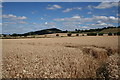
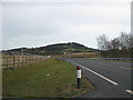
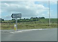
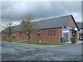
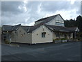


19 photos from this area
Area Information
Key information about the HR2 8EB including its size, population, and administrative classification.
- Area Type
- Postcode
- Area Size
- 53.8 hectares
- Population
- 2050
- Population Density
- 39 people/km²
House Prices in HR2 8EB
17
Properties
£434,545
Average Sold Price
£315,000
Lowest Price
£700,000
Highest Price
Showing 17 properties
| Address | Type | Beds | Baths | Last Sale Price | Last Sale Date | |
|---|---|---|---|---|---|---|
| School House, Bullingham Lane, Bullinghope, HR2 8EB | Detached | 4 | 3 | £700,000 | Dec 2025 | |
| The Gables, Bullingham Lane, Bullinghope, HR2 8EB | Detached | 3 | 2 | £405,000 | Mar 2025 | |
| The Stables, Bullingham Lane, Bullinghope, HR2 8EB | house | - | - | £315,000 | Apr 2019 | |
| Farm Gate, Bullingham Lane, Bullinghope, HR2 8EB | Detached | - | - | £320,000 | May 2018 | |
| Pear Tree Barn, Bullingham Lane, Bullinghope, HR2 8EB | house | 3 | - | £380,000 | Sep 2016 | |
| Pilgrims End, Bullingham Lane, Bullinghope, HR2 8EB | Detached | 4 | 3 | £440,000 | Nov 2014 | |
| Chy Lowena, Bullingham Lane, Bullinghope, HR2 8EB | house | - | - | £435,000 | Feb 2014 | |
| Bullinghope House, Bullingham Lane, Bullinghope, HR2 8EB | Detached | - | - | £650,000 | Jun 2007 | |
| Church House, Bullingham Lane, Bullinghope, HR2 8EB | Detached | - | - | £370,000 | Jun 2005 | |
| Fairview, Bullingham Lane, Bullinghope, HR2 8EB | Detached | 5 | - | £400,000 | May 2003 |
Page 1 of 2
Energy Efficiency in HR2 8EB
Amenities
Schools
| Rank | School | Type | Entry gender | Ages |
|---|
Explore more schools in this area
Go to Schools tabDemographics
Household Size
Two person
most common
Accommodation Type
Houses
most common
Tenure
78
majority
Ethnic Group
White
most common
Religion
N/A
most common
Household Composition
N/A
most common
Age
47
median
Adults (30-64 years)
most common
Household Deprivation
N/A
with no deprivation
NS-SEC
38
in Lower managerial occupations
Explore more demographic insights in this area
Go to Demographics tabPlanning
Planning Constraints
- Flood RiskPremium
- Ramsar Wetland SitesPremium
- Area of Outstanding Natural BeautyPremium
- Protected Nature ReservePremium
- Protected WoodlandPremium