Area Overview for HR2 6NN
Photos of HR2 6NN
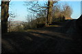
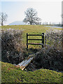


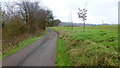
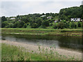
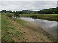
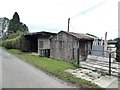
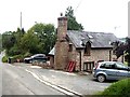
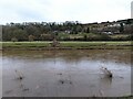

24 photos from this area
Area Information
Key information about the HR2 6NN including its size, population, and administrative classification.
- Area Type
- Postcode
- Area Size
- 37.3 hectares
- Population
- 2050
- Population Density
- 39 people/km²
House Prices in HR2 6NN
14
Properties
£428,167
Average Sold Price
£195,000
Lowest Price
£674,000
Highest Price
Showing 14 properties
| Address | Type | Beds | Baths | Last Sale Price | Last Sale Date | |
|---|---|---|---|---|---|---|
| Primrose Cottage, C 1267 From C 1266 To Rock Farm, Ballingham, HR2 6NN | Cottage | 4 | 2 | £515,000 | Jan 2016 | |
| Sheepwash, C 1267 From C 1266 To Rock Farm, Ballingham, HR2 6NN | Detached | 4 | - | £535,000 | Jul 2014 | |
| Wye Cottage, C 1267 From C 1266 To Rock Farm, Ballingham, HR2 6NN | house | - | - | £250,000 | Jan 2013 | |
| Primrose Bank, C 1267 From C 1266 To Rock Farm, Ballingham, HR2 6NN | house | - | - | £195,000 | May 2012 | |
| Fishermans Cottage, C 1267 From C 1266 To Rock Farm, Ballingham, HR2 6NN | Detached | - | - | £400,000 | Aug 2006 | |
| The Lodge, C 1267 From C 1266 To Rock Farm, Ballingham, HR2 6NN | Detached | 6 | 4 | £674,000 | Aug 2004 | |
| The Forge, C 1267 From C 1266 To Rock Farm, Ballingham, HR2 6NN | Detached | 4 | 3 | - | - | |
| 2, Pear Tree Cottages, C 1267 From C 1266 To Rock Farm, Ballingham, HR2 6NN | Detached | 2 | 1 | - | - | |
| 1, Pear Tree Cottages, C 1267 From C 1266 To Rock Farm, Ballingham, HR2 6NN | Detached | 2 | 1 | - | - | |
| Hillside Cottage, C 1267 From C 1266 To Rock Farm, Ballingham, HR2 6NN | Detached | 3 | 2 | - | - |
Page 1 of 2
Energy Efficiency in HR2 6NN
Amenities
Schools
| Rank | School | Type | Entry gender | Ages |
|---|
Explore more schools in this area
Go to Schools tabDemographics
Household Size
Two person
most common
Accommodation Type
Houses
most common
Tenure
78
majority
Ethnic Group
White
most common
Religion
N/A
most common
Household Composition
N/A
most common
Age
47
median
Adults (30-64 years)
most common
Household Deprivation
N/A
with no deprivation
NS-SEC
38
in Lower managerial occupations
Explore more demographic insights in this area
Go to Demographics tabPlanning
Planning Constraints
- Flood RiskPremium
- Ramsar Wetland SitesPremium
- Protected Nature ReservePremium
- Protected WoodlandPremium