Area Overview for HR2 6AW
Photos of HR2 6AW
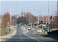
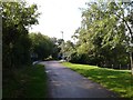
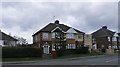
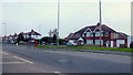
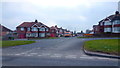
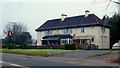
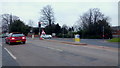
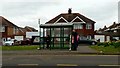
100 photos from this area
Area Information
Key information about the HR2 6AW including its size, population, and administrative classification.
- Area Type
- Postcode
- Area Size
- 8538 m²
- Population
- 1422
- Population Density
- 5137 people/km²
House Prices in HR2 6AW
24
Properties
£141,625
Average Sold Price
£46,500
Lowest Price
£220,000
Highest Price
Showing 24 properties
| Address | Type | Beds | Baths | Last Sale Price | Last Sale Date | |
|---|---|---|---|---|---|---|
| 46 Hinton Avenue, Hereford, HR2 6AW | Semi-detached | 2 | 1 | £220,000 | Oct 2025 | |
| 30 Hinton Avenue, Hereford, HR2 6AW | Detached | 3 | 1 | £217,000 | Aug 2025 | |
| 48 Hinton Avenue, Hereford, HR2 6AW | Detached | 3 | 2 | £175,000 | Feb 2017 | |
| 47 Hinton Avenue, Hereford, HR2 6AW | Semi-detached | 3 | - | £135,500 | Feb 2016 | |
| 37 Hinton Avenue, Hereford, HR2 6AW | Semi-detached | 2 | 1 | £133,000 | May 2014 | |
| 36 Hinton Avenue, Hereford, HR2 6AW | Terraced | - | - | £130,000 | Dec 2005 | |
| 27 Hinton Avenue, Hereford, HR2 6AW | Semi-detached | - | - | £76,000 | Oct 2002 | |
| 42 Hinton Avenue, Hereford, HR2 6AW | Semi-detached | - | - | £46,500 | Mar 1997 | |
| 43 Hinton Avenue, Hereford, HR2 6AW | Semi-detached | - | - | - | - | |
| 32 Hinton Avenue, Hereford, HR2 6AW | Terraced | - | - | - | - |
Page 1 of 3
Energy Efficiency in HR2 6AW
Amenities
Schools
| Rank | School | Type | Entry gender | Ages |
|---|
Explore more schools in this area
Go to Schools tabDemographics
Household Size
Two person
most common
Accommodation Type
Houses
most common
Tenure
72
majority
Ethnic Group
White
most common
Religion
N/A
most common
Household Composition
N/A
most common
Age
47
median
Adults (30-64 years)
most common
Household Deprivation
N/A
with no deprivation
NS-SEC
22
in Lower managerial occupations
Explore more demographic insights in this area
Go to Demographics tabPlanning
Planning Constraints
- Flood RiskPremium
- Ramsar Wetland SitesPremium
- Area of Outstanding Natural BeautyPremium
- Protected Nature ReservePremium
- Protected WoodlandPremium