Area Overview for HR2 0TF
Photos of HR2 0TF
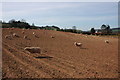
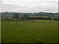
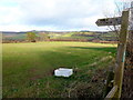
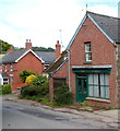
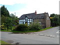
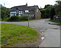
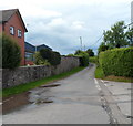

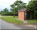
11 photos from this area
Area Information
Key information about the HR2 0TF including its size, population, and administrative classification.
- Area Type
- Postcode
- Area Size
- 37.5 hectares
- Population
- 1522
- Population Density
- 37 people/km²
House Prices in HR2 0TF
14
Properties
£251,030
Average Sold Price
£107,000
Lowest Price
£385,000
Highest Price
Showing 14 properties
| Address | Type | Beds | Baths | Last Sale Price | Last Sale Date | |
|---|---|---|---|---|---|---|
| Temple Bar, Long Lane, Peterchurch, HR2 0TF | house | - | - | £385,000 | Jun 2021 | |
| Pear Tree Cottage, Long Lane, Peterchurch, HR2 0TF | house | 2 | - | £250,000 | Jan 2019 | |
| Chapel House, Long Lane, Peterchurch, HR2 0TF | Detached | 3 | - | £162,000 | Jul 2013 | |
| Former The Old Plough Inn, Long Lane, Peterchurch, HR2 0TF | house | - | - | £330,000 | Feb 2010 | |
| Yew Tree Cottage, Long Lane, Peterchurch, HR2 0TF | house | - | - | £272,180 | Jul 2007 | |
| Vine Cottage, Long Lane, Peterchurch, HR2 0TF | Detached | - | - | £107,000 | Mar 1997 | |
| 2, Rose Cottages, Long Lane, Peterchurch, HR2 0TF | Industrial | - | - | - | - | |
| Lorry Park Adjacent Rose Cottages, Long Lane, Peterchurch, HR2 0TF | commercial | - | - | - | - | |
| Bank House, Long Lane, Peterchurch, HR2 0TF | Detached | - | - | - | - | |
| Primrose Cottage, Long Lane, Peterchurch, HR2 0TF | Detached | - | - | - | - |
Page 1 of 2
Energy Efficiency in HR2 0TF
Amenities
Schools
| Rank | School | Type | Entry gender | Ages |
|---|
Explore more schools in this area
Go to Schools tabDemographics
Household Size
Two person
most common
Accommodation Type
Houses
most common
Tenure
70
majority
Ethnic Group
White
most common
Religion
N/A
most common
Household Composition
N/A
most common
Age
47
median
Adults (30-64 years)
most common
Household Deprivation
N/A
with no deprivation
NS-SEC
30
in Lower managerial occupations
Explore more demographic insights in this area
Go to Demographics tabPlanning
Planning Constraints
- Flood RiskPremium
- Ramsar Wetland SitesPremium
- Area of Outstanding Natural BeautyPremium
- Protected Nature ReservePremium
- Protected WoodlandPremium