Area Overview for HR1 4HX
Photos of HR1 4HX
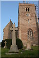
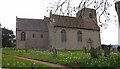
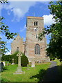

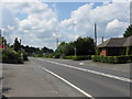
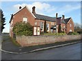
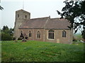
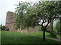
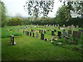

77 photos from this area
Area Information
Key information about the HR1 4HX including its size, population, and administrative classification.
- Area Type
- Postcode
- Area Size
- 2.7 hectares
- Population
- 1329
- Population Density
- 51 people/km²
House Prices in HR1 4HX
11
Properties
£356,090
Average Sold Price
£179,950
Lowest Price
£535,000
Highest Price
Showing 11 properties
| Address | Type | Beds | Baths | Last Sale Price | Last Sale Date | |
|---|---|---|---|---|---|---|
| Ampney Cottage, School Road, Tarrington, HR1 4HX | house | 2 | 1 | £310,000 | Jun 2022 | |
| Tarrington Barn, A 438 From School Road To C 1151 Via Tarrington, Tarrington, HR1 4HX | Semi-detached | 3 | 3 | £360,000 | Apr 2021 | |
| Oakapple, School Road, Tarrington, HR1 4HX | Detached | 2 | 1 | £395,500 | May 2020 | |
| Foley Cottage, School Road, Tarrington, HR1 4HX | Cottage | 2 | 1 | £179,950 | Aug 2017 | |
| The Willows, School Road, Tarrington, HR1 4HX | Detached | 4 | 2 | £535,000 | Dec 2013 | |
| Second Floor Flat, The Tarrington Arms, A 438 From School Road To C 1151 Via Tarrington, Tarrington, HR1 4HX | Flat | - | - | - | - | |
| 2, Sunnyside, School Road, Tarrington, HR1 4HX | Semi-detached | 2 | 1 | - | - | |
| Forge Cottage, School Road, Tarrington, HR1 4HX | Semi-detached | - | - | - | - | |
| 1, Sunnyside, School Road, Tarrington, HR1 4HX | Semi-detached | 2 | 1 | - | - | |
| Managers Accommodation, The Tarrington Arms, A 438 From School Road To C 1151 Via Tarrington, Tarrington, HR1 4HX | Flat | - | - | - | - |
Page 1 of 2
Energy Efficiency in HR1 4HX
Amenities
Schools
| Rank | School | Type | Entry gender | Ages |
|---|
Explore more schools in this area
Go to Schools tabDemographics
Household Size
Two person
most common
Accommodation Type
Houses
most common
Tenure
68
majority
Ethnic Group
White
most common
Religion
N/A
most common
Household Composition
N/A
most common
Age
47
median
Adults (30-64 years)
most common
Household Deprivation
N/A
with no deprivation
NS-SEC
40
in Lower managerial occupations
Explore more demographic insights in this area
Go to Demographics tabPlanning
Planning Constraints
- Flood RiskPremium
- Ramsar Wetland SitesPremium
- Area of Outstanding Natural BeautyPremium
- Protected Nature ReservePremium
- Protected WoodlandPremium