Area Overview for HR1 3SG
Photos of HR1 3SG

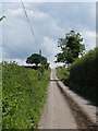
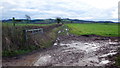
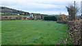
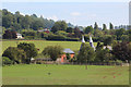
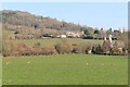
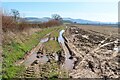
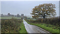

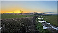


23 photos from this area
Area Information
Key information about the HR1 3SG including its size, population, and administrative classification.
- Area Type
- Postcode
- Area Size
- 74.2 hectares
- Population
- 1329
- Population Density
- 51 people/km²
House Prices in HR1 3SG
23
Properties
£299,000
Average Sold Price
£60,000
Lowest Price
£465,000
Highest Price
Showing 23 properties
| Address | Type | Beds | Baths | Last Sale Price | Last Sale Date | |
|---|---|---|---|---|---|---|
| 2, Crown Cottages, A 4103 From Pomona Lane To Lumber Lane, Whitestone, HR1 3SG | Semi-detached | 3 | 1 | £305,000 | Oct 2024 | |
| Larkholme, A 4103 From Pomona Lane To Lumber Lane, Whitestone, HR1 3SG | house | - | - | £60,000 | Jan 2022 | |
| Weston Corner Farm, A 4103 From Pomona Lane To Lumber Lane, Whitestone, HR1 3SG | house | - | - | £465,000 | Jun 2016 | |
| Withington Corner House, A 4103 From Pomona Lane To Lumber Lane, Whitestone, HR1 3SG | house | - | - | £355,000 | Mar 2006 | |
| The Poplars, A 4103 From Pomona Lane To Lumber Lane, Whitestone, HR1 3SG | Detached | - | - | £310,000 | May 2005 | |
| Hygrove, A 4103 From Pomona Lane To Lumber Lane, Whitestone, HR1 3SG | Detached | 3 | 2 | - | - | |
| The Cottage, Weston House, A 4103 From Pomona Lane To Lumber Lane, Whitestone, HR1 3SG | undefined | - | - | - | - | |
| Flat, Bankfield, A 4103 From Pomona Lane To Lumber Lane, Whitestone, HR1 3SG | Flat | - | - | - | - | |
| The Orchards, A 4103 From Pomona Lane To Lumber Lane, Whitestone, HR1 3SG | Detached | - | - | - | - | |
| Barnamore Cottage, A 4103 From Pomona Lane To Lumber Lane, Whitestone, HR1 3SG | house | - | - | - | - |
Page 1 of 3
Energy Efficiency in HR1 3SG
Amenities
Schools
| Rank | School | Type | Entry gender | Ages |
|---|
Explore more schools in this area
Go to Schools tabDemographics
Household Size
Two person
most common
Accommodation Type
Houses
most common
Tenure
68
majority
Ethnic Group
White
most common
Religion
N/A
most common
Household Composition
N/A
most common
Age
47
median
Adults (30-64 years)
most common
Household Deprivation
N/A
with no deprivation
NS-SEC
40
in Lower managerial occupations
Explore more demographic insights in this area
Go to Demographics tabPlanning
Planning Constraints
- Flood RiskPremium
- Ramsar Wetland SitesPremium
- Area of Outstanding Natural BeautyPremium
- Protected Nature ReservePremium
- Protected WoodlandPremium