Area Overview for HR1 2RA
Photos of HR1 2RA


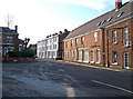
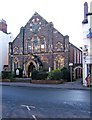
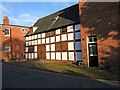

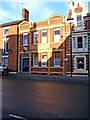
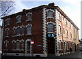
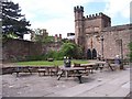
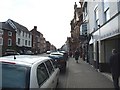
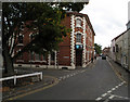
100 photos from this area
Area Information
Key information about the HR1 2RA including its size, population, and administrative classification.
- Area Type
- Postcode
- Area Size
- 4979 m²
- Population
- 1811
- Population Density
- 1781 people/km²
House Prices in HR1 2RA
35
Properties
£149,288
Average Sold Price
£38,500
Lowest Price
£265,000
Highest Price
Showing 35 properties
| Address | Type | Beds | Baths | Last Sale Price | Last Sale Date | |
|---|---|---|---|---|---|---|
| 1 Hampton Street, Hereford, HR1 2RA | Detached | 2 | 2 | £260,000 | May 2025 | |
| 12 Hampton Street, Hereford, HR1 2RA | Detached | 2 | 1 | £235,000 | Jun 2024 | |
| 7 Hampton Street, Hereford, HR1 2RA | Terraced | 3 | 1 | £265,000 | May 2024 | |
| 11 Hampton Street, Hereford, HR1 2RA | Flat | - | - | £175,000 | Sep 2022 | |
| 2A Hampton Street, Hereford, HR1 2RA | Flat | - | - | £136,000 | Feb 2022 | |
| 30 Hampton Street, Hereford, HR1 2RA | Terraced | 2 | 2 | £215,000 | Mar 2021 | |
| 19 Hampton Street, Hereford, HR1 2RA | house | - | - | £210,000 | Dec 2020 | |
| 28 Hampton Street, Hereford, HR1 2RA | Terraced | 2 | 1 | £164,950 | Aug 2018 | |
| 22 Hampton Street, Hereford, HR1 2RA | house | - | - | £166,000 | Jun 2017 | |
| 2 Hampton Street, Hereford, HR1 2RA | Terraced | 4 | 1 | £130,000 | May 2017 |
Page 1 of 4
Energy Efficiency in HR1 2RA
Amenities
Schools
| Rank | School | Type | Entry gender | Ages |
|---|
Explore more schools in this area
Go to Schools tabDemographics
Household Size
One person
most common
Accommodation Type
Houses
most common
Tenure
65
majority
Ethnic Group
White
most common
Religion
N/A
most common
Household Composition
N/A
most common
Age
47
median
Adults (30-64 years)
most common
Household Deprivation
N/A
with no deprivation
NS-SEC
38
in Lower managerial occupations
Explore more demographic insights in this area
Go to Demographics tabPlanning
Planning Constraints
- Flood RiskPremium
- Ramsar Wetland SitesPremium
- Area of Outstanding Natural BeautyPremium
- Protected Nature ReservePremium
- Protected WoodlandPremium