Area Overview for Honington
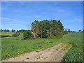
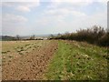
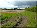
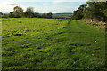
Photos of Honington


Area Information
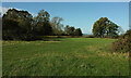
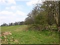
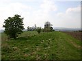
Honington is a civil parish located in England, covering an area of 10.0 km². Living in this locality means residing within a defined community that balances rural character with essential amenities. The area represents a specific settlement where residents navigate the practicalities of daily life in a relatively contained space. You will find that the parish offers a structured environment for those seeking a-rooted location. The distinct size of the parish influences how local services operate and how neighbours interact with one another across the land. Those considering homes in Honington should understand that this is a established parish with clear boundaries and a defined geographic identity. The layout supports a lifestyle where the community remains the central focus of local activity. As you explore what daily life entails, you will see how the physical space shapes the rhythm of the town. The parish setting provides a stable backdrop for families and individuals looking to settle in a recognised English locality. Researching schools near Honington reveals options within a tight-knit neighbourhood that serves the immediate population well. Understanding the area size helps you appreciate the spread of properties and the distance between key local points of interest. Honington stands as a coherent unit within the broader county landscape for anyone reviewing potential locations for purchase or relocation.
- Area Type
- Parish
- Area Size
- 10.0 km²
- Population
- Not available
- Population Density
- Not available
Demographics
The community in Honington displays a clear demographic profile, as indicated by the available statistics. The median age stands at 70 years, which signals that the population skews significantly towards older residents. This age structure suggests the area functions as a retirement destination or a place where long-term inhabitants remain settled well into later life. Home ownership is particularly high, with 76% of residents owning their property. This figure indicates a stable community where residents have built lasting connections to their local addresses. The household composition and accommodation types reflect this stability, with homes in Honington largely occupied by those who have purchased their living spaces rather than renting. You will find that the population is defined by this high rate of home ownership and the older age profile. Deprivation data is not provided in the current dataset, so local quality of life regarding income gaps remains outside the scope of this specific summary. The demographic picture paints Ver a scene of maturity and stability. Most residents likely have deep roots in the village, given the median age and ownership rates. When evaluating schools near Honington, keep in mind that the resident population consists predominantly of older adults. The community feels settled, with residents who are established in their homes and likely have known each other for many years.
Household Size
Accommodation Type
Tenure
Ethnic Group
Religion
Household Composition
Age
Household Deprivation
NS-SEC
Explore more demographic insights in this area
Go to Demographics tabPlanning
Planning Constraints
- Flood RiskPremium
- Ramsar Wetland SitesPremium
- Area of Outstanding Natural BeautyPremium
- Protected Nature ReservePremium
- Protected WoodlandPremium
- Crime RiskPremium